Saturday, July 31, 2010

No 2 resumes passage, further blockage expected


On July 29 Somerset Street was reopened under the new Chinatown Royal Arch, after a two month closure to vehicles. The No 2 bus route resumed passage through Chinatown.

The sidewalks have been relaid and provide a more comfortable and direct route for pedestrians again.

The scaffolding remains around the Arch for the use of the painters coming from China who will apply 17 coats of paint to the make the arch more colourful.

Meanwhile, just a few blocks further west on Somerset, construction has started for the new utilities and streetscaping. Major work will be completed this fall, but landscaping won't be completed until fall 2011. We can expect some further blockage of the street both this year and for about two months in 2011.

Friday, July 30, 2010

Gov't Downsizing


These mini-traffic lights were on a post in Gatineau. I could not determine if they were for cyclists. Or pedestrians. Or if they went off and on with the bigger lights.

I recall seeing these everywhere in France, but that is because they skip the big light fixtures on the far side of the intersection in favour of big ones over the stop line only.

The plethora of push buttons didn't make it any clearer. I eventually walked my bike across against a red light (I was on a bike path detour that led me to the intersection and abandonned me).

It felt like bait and switch. Segregated bike path: good. Detour sign -- they were thinking of me! good. Abandonned at the intersection: bad.

Ottawa has more overhead traffic signals than anywhere I have been in the world (and that's lots of places!). More signalized intersections. More signals at the intersection. More posts. More big metal arms. More signage. No wonder we are high tax and low results sort of place, the highest and best use of tax dollars is installing signalized intersections. Maybe, just maybe, the new age of austerity will give us these cuter, more friendly and human scaled signals.

Thursday, July 29, 2010

Enjoying nature


I was cycling around the Ottawa West neighborhood the other day: Northwestern, Cowley, Patricia, Carleton.

This long lineup of parked cars is on the roadside parking lot where a neighborhood path goes under the Ottawa River Commuter Expressway. Once on the path, I looked for all these people, but the area was deserted.

Alas, they were just the abandonned bits of personal transporters left behind by cubicle farmers at Tunney's Pasture. Free parking, no posted time limit.

Wednesday, July 28, 2010

Tuesday, July 27, 2010

Animating LeBreton Flats streets


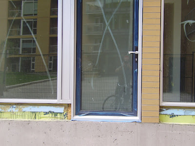
The picture above is a new condo door installed by Claridge on its ground floor condos on Lett Street (LeBreton Flats, under the yellow tower).

It is highly significant.

City and NCC plans for the development call for animated streets, full of people walking, playing, shopping ... but the first phase building as regular sliding doors on all ground floor units. You know, patio doors. No lock nor key to access them from the outside. No lobby space inside those doors, just step straight into the living room. In short, the developer paid lip service to the notion of animated streets but built the opposite.

The second phase of the first building faces Lett and Fleet Streets. The ground floor units (mostly) have hinged glass doors. With exterior handles. And locks. So someone can actually come and go at street level.

It is an improvement.

Monday, July 26, 2010

Sidewalk to No-where

the sidewalk on the west side of Sliddel approaching the Ottawa River Commuter Expressway


The sidewalk on the east side of Sliddel

Sliddel is a little street that connects the new trafic roundabout at Bayview-Burnside to the Ottawa River Commuter Expressway. As shown, it has sidewalk stubs that sort of die as they approach the NCC lands.

The City and NCC had no apparent problems with deciding where to put cars, curbs, traffic signals, and sod. They have lots more problems with pedestrians and cyclists.

Why dont the sidewalks go right out the traffic lights where people cross? According to city staff:
At the time of our project design, they indicated to us that they would not support a pedestrian crossing across the Ottawa River Parkway at Slidell Street.


That being said, we have just worked out some details with the NCC to improve the accessibility at this intersection, in advance of the completion of their overall plans for the area in conjunction with future developments. Painted cross-walks, pedestrian push buttons and depressed curbs should be installed at the intersection within the next few weeks.

Things are not quite so optimistic for cyclists. The roundabout lacks cycling guidelines, preferably instructing cyclists to take the centre of the lane. The City is consulting with the traffic and cycling dept to see if anything is warranted.

Saturday, July 24, 2010

The east is red

Woodblocks with Chinese wishes on them, to be stamped into the red cement at the Chinatown Royal Arch.


Placing the imprint at the corners of red cement inserts beneath the arch.


Detail of the roof tiles.

The road detour at the Chinatown Arch comes off at the end  of this week.

Chinese artisans arrive next weekend for the next phase of the Arch project: installing 17 coats of paint on the arch.

For more frequent Arch pictures and news, go to http://www.ottawachinatownroyalarch.blogspot.com/


Friday, July 23, 2010

Highway to nowhere


The city's roads department has its signals branch located on Gladstone on either side of the O-Train cut. The yards are full of signal poles and light fixtures. Mostly these lights are "out" at night; but one recent evening there were multiple heads cycling through red-yellow-green.

 Immediately behind them is a dense patch of bush, through which a ped path winds that will someday become the cycling path along the Otrain corridor.

Thursday, July 22, 2010

Metering thoughts


The City continues -- with some delays* -- to replace parking meters with pay-and-display kiosks.

The old meters are not immediately removed, however, since motorists are used to what they look like and seek them out. Instead, each one is converted for six months or so to signs telling motorists to look for the pay-and-display kiosk.

After that breaking in period, the old meters are removed. All of them. A small percentage of them -- 12% --  will be retrofited to become bike hitching posts. The city will then go out to find places to locate these new posts.

Some meter posts perhaps should be removed. The ones immediately adjacent a curb, for example, which would sometimes get in the way of car doors [more car first thinking here...].  But the city being run on a rational and systems based approach, instead of removing just the problem posts removes ALL of them, and will send out crews to reinstall them in new locations. Criteria had to be developed for where they will be put. Not along the curb. Not along buildings or fences (as in the picture above) because then cycles cannot be put on both sides of the post.

Wouldn't it have been cheaper to identify which posts need to be removed, and left in place the ones that could be converted to cycle posts? Under the city's plan, we go to the expense of removing all the posts, developing a new location plan with all sorts of location criteria, and then reinstalling the posts, which is so expensive it will take years to get just some of them reinstalled. I'm willing to bet that while parking meter posts could be squeezed in anywhere they city wanted, the new cycling post criteria will be so tough we will shortly be told we can't have a post here or there because they dont fit the criteria.

Local businesses are annoyed at the lack of bike parking posts now. With the removal of the meters, there will be even fewer hitching posts. I already see cycles locked to benches and trees along Preston. Both the Somerset/Chinatown BIA and the Preston BIA have asked the city to do a one for one replacment of parking meter posts for cycle hitching posts, and the response was negative.

Next summer, when all the old parking meter posts are gone, and the few recycled cycle posts are in ... the shortage will become apparent. Four thousand parking meter posts will be missing, only 500 new posts may have been installed. Media can pencil it in for next June: write story on shortage of bike parking spots.


*delays ... the new pay-and-display kiosks are made in France. There have been delays getting them to Ottawa by shipping container as this is a peak-season for trans-atlantic shipping, and now the port of Montreal is closed due to a labour dispute.

Wednesday, July 21, 2010

A different climate


This is the centre boulevard of Carling Avenue. The section from the Otrain to Bronson is to be reconstructed in 2011. This section will NOT be dug up  should the city decide to run an LRT along the Carling median. Also note that the city plows streets to the side only, so the centre boulevard is not used for snow storage. So what is put down in the 2011 reconstruction is what we will see for the next half century or more.


At the open house, I suggested the median be landscaped properly. I suggested there be a 18" setback from the curb, then a 2' wall be constructed and the centre filled with great dirt or structural soil and planted with trees, shrubs, or even decorative grass. The City planners wagged their heads no...no...no. The stuff wouldn't survive. It couldn't possibly work. Besides, there's already a nice park to the south ... as if the NCC facilities obviate the city from ever bothering to do something nice to their lands.


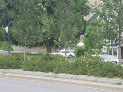
Here is Allumettes in Hull Gatineau. Remember when Hull was the poor cousin to Ottawa? Well, the story is different now. Note the decorative centre light standards, the lush planting, the close row of trees, all apparently thriving in their hostile climate north of Ottawa.


The centre plantings are so lush they partially obscure the cars on the other side, thus reducing the apparent width of the road and ameliorating its impact on the urban environment. Gatineau can do it ...


Close up of plantings and two rows of curbs. Plantings included rose buses, lavender, shrubs, and trees.


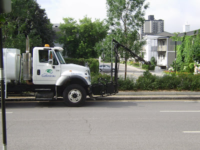
A maintenance crew doing a summer weeding. They told me its once a year.


After weeding, a watering (fertilizer?). The resultant lush attractive streetscape shows the results of the manicuring work.


Another section, planted solely in tall grasses.


Thick planting of attractive greenery makes a rich boulevard -- only in Gatineau you say, pitty.


An older section, with higher planter walls making a clearer separation of the roads on each side of the centre boulevard.


Carling Avenue boulevard. Other than the car models, its exactly the same as 1955. Will it look the same in 2055??


Tuesday, July 20, 2010

More on Bronson Road Diet

This morning the CBC did a follow up interview on the problem with Bronson. They interviewed Dan Burden, who is a leading proponent of road diets. I have used his materials in suggesting to the city that Bronson needs to be put on a diet, and their answer, without any justification, is always ... "no".

You can listen to his interview here:  http://www.cbc.ca/ottawamorning/
Select the story called "road diet". He points out that some cities are already up to their thirty-third road being put on a "diet" and dear old Ottawa won't even consider putting one road on a diet. Sigh.

New and Improved ?


It has stopped raining. These puddles at the corner of Louisa and Preston are a real wet foot hazard and splash hazard to summer pedestrians; and will be slush and ice hazards in the winter.

We can put a man on the moon, send a politician to a conference, but somehow can't quite get the water to drain off crosswalks or sidewalks.

Monday, July 19, 2010

Bronson road diet

Your blogger was interviewed on CBC radio this morning about the Bronson issues. He was also a news story in the local news lineup. You may be able to hear the interview by going to
http://www.cbc.ca/ottawamorning/

and selecting the "fake trees" item.

The story must have gotten some feedback, since they followed up looking for additional people to interview in the coming days on the subject of road diets.

Place de Dominos


Over the last while, workers have been busy on scaffolding painting the exterior of Place de Ville. The plain square glass box dates back to the late 1960's. It lacks any sort of top or lid, and was bronze and black. Workers are painting various parts of it with primer, then the final coat of ... bronze and black.

In its current condition, it reminds me of the new building complex in New York, called the Domino. The building exterior is a box that has been articulated with various coloured squares. The building lots like a colourful domino, and is to be built on the site of the former Domino sugar plant.

While this isn't a former sugar plant, it is a cubicle farm, and I think it could be improved with a polychrome paint exterior. And I would make some of those paints the ones that change colour if hot, or wet. In this way,  the building would be a cheerful colour when wet, a cool colour in heat waves, a warm colour in winter ... sort of like those colour-change hot wheel cars we had when we were kids.

Sunday, July 18, 2010

Light shining on St Anthony


St Anthony school on Booth Street is getting some new windows. The new pattern, shown in the photo below, looks more in keeping with the architecture of the school than the old windows coming out.


Saturday, July 17, 2010

Milky rain, milky rain


It was raining the other day, and there was this curious milky substance running down the curbside gutter. I followed it back to the source: the road construction sign.

The back of the sign is painted white, and in the rain the paint just washes off.

I wondered if maybe the sign had anti-graffiti treatment on the back, so the paint would not stick.

In the meantime, what does all this while paint do to our sewers?


Friday, July 16, 2010

Look up, way way up...

No, this is not a story from The Friendly Giant.


Charlesfort is an Ottawa builder of deluxe condos. His exteriors have character, drawn from past architectural styles. He built The Gardens at Bronson/Albert and one at Bronson near Carling in the MacIntosh style (not Apple, nor Steve Jobs, but in the style of a Scottish architect).

Their latest projects are in the art deco style. Shown above is the roof line of the Hudson in downtown Ottawa on Kent Street. The style attracts the eye upwards, only to be distracted by a large silver chiller unit mounted on the roof. Tacky. (the picture was taken from Somerset St, the red brick building in the foreground is another project).

I was surprised to see the chiller looks different now than from a few weeks ago. It is no longer bright silver, it seems to have been painted with a muted sky and cloud motif, that makes it blend in much better with the skyline. Kudos to the condo board or Charlesfort for doing so.

 The same firm has similar art deco style buildings underway on Richmond Road near Woodroofe and opposite City Hall on Lisgar. But next time, just put the chiller inside a mechanical penthouse. It's better to design it right than to cover it up.

Thursday, July 15, 2010

The race is on ...


Preston reconstruction is almost complete. Final details are going in ... like the traffic loops.

The loop shown above is going to be installed right outside May's Chinese Restaurant at the corner of Somerset and Preston.

Except ... on August 3rd Somerset is going to be dug up big time for the same treatment as Preston got for the last few years: new pipes, utilities, and protected parking bays. Guess what -- the spot shown above will be getting a six foot or so wider sidewalk. And four trees.

Will the city get the wiring installed in enough time to get it torn out in August? Or will they be so slow the installation crews will arrive to find the road already gone??  Stay tuned for the great race...

Wednesday, July 14, 2010

Economical thirst quenching


My bike panniers will each hold a six pack very nicely. It's a bit too precarious to fit in a 12 pack.

If you go to the LCBO, two six packs will cost you the six pack price times two.

If you go the Beer Store, their policy is two six packs will cost you a twelve pack (and two twelve packs costs same as a 24).

I think the Somerset Beer store is a fabulous place. Except ... expect some long lines if you show up at 10am Monday (recycling day).

Tuesday, July 13, 2010

Lemieux Island area (iv)


At the south (Ottawa) end of the Prince of Wales railway bridge over the Ottawa River, the City has installed large gates & fences to keep peds and cyclists from using the bridge as a shortcut to Gatineau.

Thwarted peds have kicked down the fence, whose posts were bolted into concrete, etc etc.

There is a security guard on the Gatineau side, 24/7. If someone crosses the bridge, he points out the fence is there to keep people off because it is dangerous to use the bridge. So he sends the ped or cyclist back to the Ottawa side. There is a certain logic in this.

Would it be too logical to notice the obvious: there is a strong desire by peds and cyclists to use this bridge to join Ottawa and Gatineau. *  Rather than a fence, how about installing a deck and repairing the cable railing, and actually let people use the bridge. Imagine, an interprovincial bridge without cars! Naw, couldn't be done.


*Even Mr Greber called for it to link the Airport Parkway via a road through Carleton to the Champagne Parkway to the bridge to Fairy Lake Parkway to the Gatineau. We hopefully will never get such a road ... but a cycle path would be useful.

Monday, July 12, 2010

Is street cuisine killing our trees?


For years chip wagons parked outside the (now demolished) Canadian Tire store on Richmond Road. The store may be gone, but the chip wagon remains.

All winter, the snow bank between the chip wagon and the line of trees abutting the school yard is sodden and discoloured with greasy water that somehow gets discarded on the public boulevard. The patrons lined up don't seem to notice or mind.

Now, one of the 30' high trees along this stretch has died. If grease clogged the tree arteries and killed it, what is it doing to our human arteries??

And will the chip wagon remain once the many condos are occupied at 101 and 111 Richmond Road (to say nothing of those on the Our Lady of the Condos monastery site...). Invite guests for dinner ... take in chips ... um um. Ottawa street cuisine at its finest.

Sunday, July 11, 2010

Lemieux Island area (iii)

Lemieux Island has a pleasant park on west and south sides of the Island. Most of the Island is fenced off to guard the water filtration buildings.

This vehicle-proof gate and lengthy stone barricade prevents vehicles from accessing a service road around the south side of the Island. The narrow road/path beyond has nice pedestrian-scale lighting and is a popular dog running / dog swimming / occasional-human swimming area.

The barrier to prevent unauthorized vehicle access, which is fine. But why does have have to block 100% of the paved surface, forcing peds to walk on the freshly seeded sides? Doesn't anyone plan for pedestrians or cyclists??


While not terribly attractive, this barrier on Echo Drive is much more pedestrian and cyclist friendly. Just cycle or walk on through. Easy peasy. No curbs to jump, nor fences to climb. This type of barricade is compliant with the ideals of bicycle boulevards (long stretches of street that thwart through-cars but encourage cycling).

Saturday, July 10, 2010

Lemieux Island area (ii)

A few years ago the City ran one of its high pressure water mains along the north side of the Ottawa River Commuter Expressway (said expressway being at the top of this slope) from Lemieux Island towards the downtown.

The city contractors re-landscaped the dug up areas. Surprise, surprise, the shrub beds withered away, the trees languished ... and for the last few weeks the NCC has be re-doing the city work. Shown above are new shrubs on the slope between the expressway and the river edge bike path near the Prince of Wales bridge.


The shrubs are planted, mulched, and being watered.

The NCC also replaced a number of the trees the city planted.

I wonder how the NCC views the City's attempts at landscaping? Like a little child, trying, but failing and inept? Like a recalcitrent child, who goes through the motions but sullenly and without interest in the result? Or like a pesky mosquito, just brush it aside and do what needs to be done, properly?


Friday, July 9, 2010

Interprovincial Transit Link


Earlier this week, the NCC held a public open house on proposals for improving interprovincial transit. I blogged on my general preferences (a LRT link using the Prince of Wales  bridge) a few days ago, http://westsideaction.blogspot.com/2010/07/interprovincial-transit-opportunity-to.html

At the meeting, a number of matters came up that caused me to ponder.

Bridge repairs... the cost of the LRT on the loop was much much higher than that of Bus Rapid Transit (BRT). I inquired as to why the order of magnitude numbers for LRT were so much higher since both were surface crossings. Well, to use the Chaudiere, Alexandra, or Prince of Wales bridges, massive rebuilding would be "required" of these older structures. This rebuilding cost was added to the LRT cost.

But wouldn't these repairs and rebuildings still be required if there was no LRT and the bridges continued to be used by cars and buses like they are today? Yup, I was told, they would require the same rebuilding, at the same costs.

So why do the planners add the reconstruction cost into the LRT option cost when it is a cost that has to be met anyway, even if LRT is not built? The bridge repair costs are not unique to choosing the LRT option. [hint: by adding bridge rebuilding costs, costs might be divided three ways - city, province, feds - instead of remaining 100% to the bridge owner. Nice try for shared dollars, but it makes LRT scarily expensive when the bridge cost will be paid whether we stick with roads or go with whatever form of transit we choose].

Something similar comes up for the Preston Extension. Preston is to be extended out meet the intersection of Vimy Place in front of the War Museum. This road link will be built early in the DOTT process so cars can avoid construction on Booth. After LRT is running, motorists continue to benefit from having a new four lane road built across the Flats. Surely this cost should be stuck in the road budget, but no, its put into the LRT construction budget.

DOTT Capacity: In the many DOTT meetings I have attended over the past years, the consultants always use passenger forecasts that INCLUDE ALL THE STO passengers in the tunnel. They do not assume there is any STO bus service left through the downtown.

There are several options for Quebec links if the linkage is by LRT. One is for Quebec-bound residents to go into downtown Ottawa subway stations and take an LRT to Bayview, and then transfer to a separate LRT service to Gatineau. If their destination was other than downtown Gatineau, they would then need to transfer again to bus service.

The other option was for a separate Gatineau-bound LRT train to run through the downtown tunnel, across the Flats, and then over to Gatineau, making the whole interprovincial trip in the same vehicle. This is a more attractive option than having to transfer LRT trains, and ties in nicely I thought with the design of the Bayview Station which allows trains leaving the downtown to go west  or north/south without transfers, ie same car service from the downtown to airport, or downtown to Baseline. I was really surprised then to hear some of the experts at the event declare that the tunnel would be full to capacity with OC Transpo LRT trains and there simply would not be room for Gatineau-bound trains unless another tunnel was bored just for the "loop" service.

While I confess to some scepticism about this advice, I do wonder if the DOTT planning team is planning their station designs so that someday a third or fourth track could be added to the two originally planned, ie, keep the same stations and escalators and mezannines but increase the carrying capacity by adding additional tracks.

Bus noise: I am concerned to see some of the interprovincial transit options including running way more STO buses through the downtown than before. Way to go ... Ottawa residents will pay to go deep underground while Quebecers inherit the streets. Result: despite the reputed superior fashion-sense of Quebecers, there would be no net improvement to the street environment.

And, the NCC evaluation criteria did not seem to consider the noise of BRT on adjacent residents or quality of life in downtown neighborhoods. Traffic noise is a big factor for downtown residents, it is bizarre to be planning for major increases in bus use without even mentioning the noise and dirt and deteriorated quality of life that would engender.

Almost as bad, and taking some sort of prize for short-term thinking, was the suggestion to run STO buses across the Prince of Wales bridge to a transfer station on the Flats at Bayview. It was a mistake made decades ago to convert the Alexandra bridge from rail to car, and now we are looking at mega-bucks to convert it back ... why on earth would we do the same mistake to the POW knowing that in 20 to 30 years we would be converting it back to rail?

Finally, a comment on how we treat transit users. A certain percentage of users have limited transportation choices, due to income constraints. They'll take the bus because they don't have a {second, third} car. They are captive. They will suffer through buses that get caught in traffic. Or are routed into giant ditches, while motorists get millions of dollars spent to have "scenic" routes into the core.

But if we want transit to be a viable, lifetime option for individuals who do not have cars (the young, elderly, lower income, students, enviro-nuts, etc) or who can choose to drive but don't, or if the city wants to shift modal split onto transit to avoid building ever more roads, then it has to offer attractive amenities to induce the ridership that has a choice.*

 For the downtown loop, I love the idea of the LRT taking the Prince of Wales bridge because it offers great views to riders; and if the other part of the loop used the surface of the Alexandra bridge (which was designed and built, like the POW, as a railway bridge) then there would be even greater views. Imagine, taking the loop would be a scenic, attractive activity bringing sensory pleasure to the ridership. It would even induce tourist traffic just because it would be so nice. Sane tourists going to big cities use transit and avoid bringing their private car downtown -- or does Ottawa want to remain small-town with acres of its core dedicated to storing automobiles?

If transit is to be a viable competitor to surface roads and private cars, then it can't always be shoved onto the least-attractive corridors or into ditches. As far as I know, LRT trains won't shrivel up in the sunlight, passengers won't morph into zombies if they have a nice view. Maybe the comatose cubicle farm inhabitants snoozing in their LRT trains will wake up with some of that famous NCC landscaping.


*[I kinda like the Ottawa River Parkway routing option for the west LRT just for that reason: it gives transit users a first class view. And it might even do that by bumping two lanes of the Ottawa River Commuter Expressway off the waterfront.]

Lemieux Island area (i)

The area of Ottawa near Lemieux Island is full of little mysteries. Shown above is River Street (no road signs...) which connects the Ottawa River Commuter Expressway to Lemieux Island. The road was recently rebuilt and seed sprayed on both sides after years of digging it up for the high pressure watermains.

The sides are fenced to keep cars from using them for Bluesfest parking.


South of the parkway/expressway, the little street is now named Sliddel, it runs past the city parking branch offices to the new traffic roundabout that makes a three point meeting of Sliddel with Bayview and Burnside Road. This is a very attractively landscaped little bit of roadway. I remain astounded the city put in such intensive landscaping in a to-be-redeveloped-someday-area and then it refuses to plant even a single tree in other neighborhoods (eg City Centre Avenue, or along Albert-Scott).


The nice landscaping along Bayview. The area beyond has yet to be remediated (de-polluted) and will someday be redeveloped with streets and apartments. In the meantime, the city steadfastly refuses (as it has since I started nagging them in the 1980's) to do any landscaping along Albert Street as it's "only temporary" although redevelopment is not likely before 2030.


Thursday, July 8, 2010

Prince of Wales maintenance

Picture taken yesterday from the bike path on the west side of the War Museum, looking upriver. A service vehicle is on the Prince of Wales bridge near the Quebec side.


Closer view, shows the vehicle has two sets of wheels, rubber ones for the road and steel wheels for driving on rails. What it is doing?


Men in cherry picker extendable arm are working on the side of the bridge.


Arm continues to extend, now right under the whole bridge, the men are beyond the far side of their vehicle. It is rather like using your left hand to scratch your right side.


Working on the underside. Double click to enlarge.

Recently while cycling past the Quebec side of the POW bridge I noticed a security guard on duty, guarding the track/bridge. Upon questioning, I found out there is a guard on duty 24/7. He prevents people from cutting across the river via the bridge (the big fences at each end having been kicked down by thwarted peds). Upon further questioning, he said he was guarding the Fibre Optic Cable (FoC -- as seen frequently painted on downtown streets, along with Bell and other cables that get marked). What is there to steal in FoC? I thought FoC was plastic tube, not copper wire.