Showing posts with label pedestrians. Show all posts

Monday, July 26, 2010

Sidewalk to No-where

the sidewalk on the west side of Sliddel approaching the Ottawa River Commuter Expressway


The sidewalk on the east side of Sliddel

Sliddel is a little street that connects the new trafic roundabout at Bayview-Burnside to the Ottawa River Commuter Expressway. As shown, it has sidewalk stubs that sort of die as they approach the NCC lands.

The City and NCC had no apparent problems with deciding where to put cars, curbs, traffic signals, and sod. They have lots more problems with pedestrians and cyclists.

Why dont the sidewalks go right out the traffic lights where people cross? According to city staff:
At the time of our project design, they indicated to us that they would not support a pedestrian crossing across the Ottawa River Parkway at Slidell Street.


That being said, we have just worked out some details with the NCC to improve the accessibility at this intersection, in advance of the completion of their overall plans for the area in conjunction with future developments. Painted cross-walks, pedestrian push buttons and depressed curbs should be installed at the intersection within the next few weeks.

Things are not quite so optimistic for cyclists. The roundabout lacks cycling guidelines, preferably instructing cyclists to take the centre of the lane. The City is consulting with the traffic and cycling dept to see if anything is warranted.

Tuesday, July 20, 2010

New and Improved ?


It has stopped raining. These puddles at the corner of Louisa and Preston are a real wet foot hazard and splash hazard to summer pedestrians; and will be slush and ice hazards in the winter.

We can put a man on the moon, send a politician to a conference, but somehow can't quite get the water to drain off crosswalks or sidewalks.

Saturday, May 29, 2010

Sidewalk sales


One of the purposes of the new wider sidewalks on traditional mainstreets is to encourage merchants to display merchandise outside, which enlivens the environment with changing displays. Recently, Preston Hardware has started taking advantage of the very wide sidewalk in front of their store.

Part of the display is pretty ordinary hardware stuff: wheelbarrows, lawnmowers. The BBQ on a stone-faced cabinet is more different, and reflects the trend to "outdoor kitchens", although a visit to any of the remaining Italian households in the neighborhood will reveal a kitchen in the garage for summer cooking and pickling. There is a house near mine where the Asian residents have a large outdoor grill (perhaps removed from a chip wagon) attached to the window frame and they cook outside by reaching through the window.

In the fall, I expect the hardware store to have wine barrels, crates of grapes, etc on the sidewalk, like Musca's does now on Somerset Street.

What else would be interesting for a hardware store to put out on the sidewalk? Sledge hammers? shower stalls? waterless toilets? A door knob display? Let me know what you think would be neat on the sidewalk, and I'll pass the suggestions on to Preston Hardware.

Thursday, April 1, 2010

Think Thin

Downtown neighborhoods can have a tremendous variety of amenities, depending on the neighborhood history, road allowances, and other oddities that pre-date modern standards that too often result in in a blah uniformity of environment. I particularly like this narrow sidewalk, one block north of Beech, off Preston.


This sidewalk is less attractive, mostly because of the close proximinity of the rough stucco wall of the adjacent restaurant, and the presence of the lamppost (pardon... street furniture) plopped down in the centre of the walk along with a stop sign that is about 25' from the corner. The kitchen staff of the restaurant often sit out on this tiny sidewalk for a smoke... sort of like a sidewalk patio for the lower paid rest of us.


In marked contrast, the new wider sidewalks of Preston offer lots of room for pedestrians and patios and other street activities. The completing touches, such as trees and shrubs, will be arriving shortly. By June, the streetscape should be remarkably green and pleasant. Then it is up to the merchants and residents to make the best use of the new spaces.

Tuesday, March 9, 2010

Aloha Crosswalks

Faithful readers will know how disappointing I find Ottawa crosswalks. At the risk of beating the old drum one more time... examine the above crosswalks in Honalulu. They are as wide as the entire widened sidewalk, ie from building facade to curb line. They are brightly marked with zebra stripes.  While you are at it, notice the decorative lamp posts used throughout the downtown and Wakiki areas, and chinese tiles on the building awning.

Now compare those picture of how Honalulu does it right... to these ones of Ottawa. Feel free to come up with your own comparisons: for example, Bank Street now has wide sidewalks - do the crosswalks line up? are they nearly as wide? Shown below are two intersections on Parkdale and one on Preston:

I suspect Ottawa sidewalks are positioned relative to the stop line for vehicles and vehicle lanes, and with little regard to the sidewalks they are supposed to be connecting. Whether the sidewalks are "regular" sized, like two of the pictures above, or the new very wide sidewalks alongs parts of Bank, Preston, or West Wellie (and soon... Somerset) the crosswalks tend to be much smaller, narrower, and from a pedestrian point of view -- randomly placed anywhere but in a straight line.

Friday, March 5, 2010

Aloha streetscaping


Downtown Honalulu and Waikiki have spent many millions improving pedestrian environments ( I heard the number $535 million spent, but cannot confirm that). The main shopping drag along Waikiki beach (a successful example of a main street environment on one side, a recreational facility on the other) goes by buildings rangeing from brand new to one hundred years old. They are all built a slightly different setbacks, elevations, and angles. So the new sidewalk, of brick, varies in width, elevation, slope, and amenity.

In many places, "islands" of plantings divert ped flow into multiple chanels and create pockets of space for buskers, artists, cafe tables, etc.

In the above picture, the sidewalk has been pulled back from the road surface by about five feet and then installed right up to the storefronts built in the 1980's. There is a short wall on the curb side and generous planting of ground covers, shrubs, and trees on the slope of planter bed that goes to the curb. The result is great privacy from the cars, a sense of separation and safety, without losing the animating effect of having vehicles go by.

The street is curently three, four, or in some places, five lanes wide. I suspect the widened sidewalks and improved ped environment came from removing vehicle lanes. There was no on-street parking, but there were bays installed for delivery vehicles and drop offs (no waiting!). I couldn't help but wonder what Rideau Street would look like with generous green planters and trees down both sides in front of the Rideau Centre. Something to keep in mind when the underground LRT replaces most of the surface bus routes.

Thursday, March 4, 2010

Aloha pedestrian priority


In the above pic from Hawaii, the road parallel to the beach is one way for motorists from right to left across the top of the picture. They can turn onto the one way street extending downwards to the right, only on the green. There is no turn on red.

When the motorists have a green light, they can go straight ahead or turn to their left; peds have a red light. When the cars have a red, peds have a green to cross in all directions, including diagonally. No diagonally crossing peds are shown in this picture, but I saw lots of them in the time it took to consume a beer and plate of nachos.

So how would Ottawa handle this situation? First, no diagonal crossing: pedestrian desire lines must be thwarted at all times. Second, can anyone image the all-ped-green vs all-car-green signal cycle in Ottawa? What is more likely here is that both motorists and pedestrians would have the same green light cycle for the alignment parallel the beach, and left turning vehicles would have to thread / bully their way through the crossing pedestrians. Then the cars would have a red light, while peds got a green one to cross (straight line now!) towards the beach. The resulting mixing of peds and cars and buses is unsafe. The solution used in Hawaii was simple and effective. Has anyone seen such signalling employed in Ottawa? in Ontario?

Monday, March 1, 2010

Sidewalk Engineering


I have some tolerance for dilapidated infrastructure in the city. Not everything can be perfect. And I rationalize away some of the puddles at crosswalks as being products of 60 year old roads, old neighborhoods, etc.

This makes it doubly disappointing to discover that sometimes newly rebuilt roads and sidewalks are no better. The photo above is at the corner near Billy's Appliances on Richmond Road, beside Our Lady of the Condos. Yes, it is the final pavement, the catch basins were not unusually blocked (anymore than they are designed to be) ... its just that the sidewalk at the corner is the lowest spot around rather than a higher spot.

But its not as bad as this picture:


This is the brand new asphalt sidewalk and bike path leaving the Baseline Transit station. Looks deep to me. I expect to see ducks or geese there next time. The western city hall outpost of Centrepointe is in the background, the city's engineering depts are located in the Constellation Drive building slightly off screen to the right -- you know, the one with a hundred acres of snow parking lot, free, for employees, even though they are located right at a transit station.

I think we will continue to have drainage problems at intersections as long as we continue to design our rights of ways for cars and not pedestrians. For pedestrian benefit, drainage should be away from the curb to catch basins in the centre line of the street. This would have the additional benefit of making the street undulate from basin to basin, which would reduce speeding. Got that? It's that simple: drain away from sidewalks, not to them. Encourage pedestrians to walk on the dry parts, not the wettest part of the road.

Tuesday, January 26, 2010

S'no banking fun


One of the less joyous parts of winter is climbing through icy snowbanks on tiny rutted paths. Would you believe this is the main pedestrian entrance from the street to a bank?


At this squeeze point, the snow-bound bike rack forms a minor handhold function. And I thought banks were holding my hand, offering me an easy chair ...


This is the front of the CIBC at Preston & Carling. Their snow plow service plows the front door walk by pushing the snow from the parking lot across the front into pedestrian-blocking heaps at the Preston and Carling public sidewalks. I guess they figure everyone comes by car ...

Friday, January 15, 2010

Somerset Streetscaping - can it get back on the road?


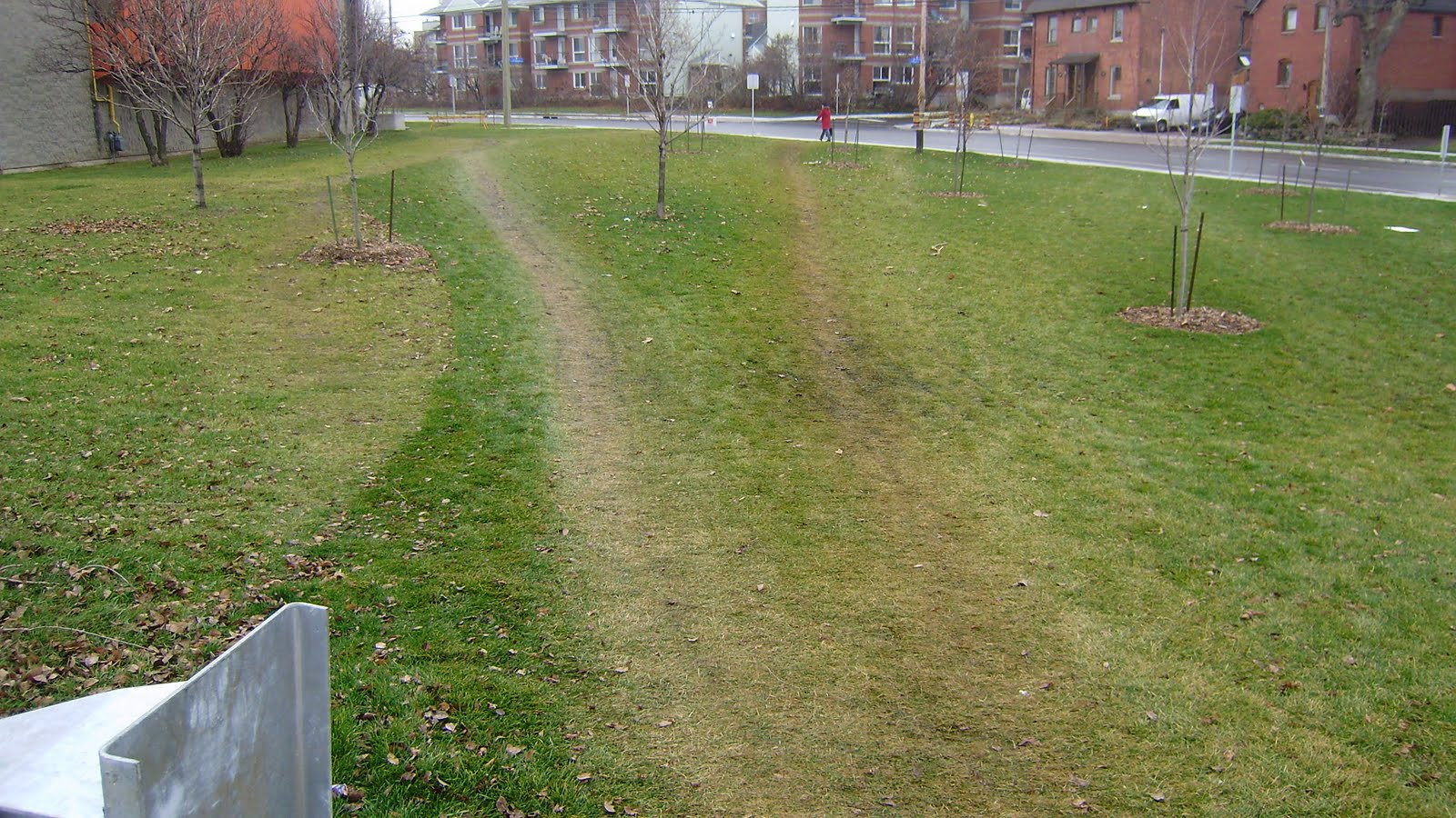
The first meeting of stakeholders got together on Tuesday evening to discuss the streetscaping project on Somerset Street. The 2010 portion is from Preston to West Wellie. The portion shown above is in the Preston BIA catchment area. The portion beyond the bridge is in Hintonburg (Kitchissipi ward) and the Hintonburg BIA.

In 2011 the section from Preston to Booth will be done. That is the area behind the viewer in the above picture. It falls in the Chinatown BIA.

Yup, in a territory walkable in barely five minutes, there are two wards, 3 BIAs, 2 community associations, and other stakeholders. A nice streetscaping project might be do-able if the parties remain able to talk.

On the surface, the meeting was OK, with a few strongly expressed opinions. The main object of discussion was what style of lighting and paving should be installed on the Preston to Otrain section. This necessarily involved discussing what styles should be on the Otrain to West Wellie section, and up the slope into Chinatown.

 But still waters run deep. Since that meeting, my emails and phone have been busy with an extraordinary amount of traffic, all expressions of concern or dismay, many expressed much more strongly than the vague discontent I felt as the meeting ended.

I even received TWO notes of condolence, sent to me as President of the Dalhousie Community Association.

 It was a public meeting, for sharing opinions by a variety of neighborhood stakeholders. It did not help that one BIA seemed to not understand that basic premise and took an aggressive position and brooked no possible other opinion/compromise, and questioned that anyone could even consider anything on the street other than their opinion, or that the street could have any identity or be considered anything other than an expression of its BIA.

I got the impression (a view shared by some others) that the consultants and other city planners had some prior position-setting interactions, and the meeting was steered towards a pre-determined position that streetscaping should reflect jurisdictional zones rather than other understandings of what makes a neighborhood. It would have been better to have simply laid down the rules, if that was the case, rather than working through a bunch of ideas and dicusssions to end up at a predetermined point as that simply leaves  attendees feeling manipulated or ignored.

The planners suggested that the Somerset viaduct is a significant topographical feature to celebrate, and proposed a "thin bright line" of another paving style and light standard for this area. The area to get this special celebratory treatment might be very short (100' of road over the Otrain track) or longer, extending  further east towards Preston.

The planners seemed to have a tin ear to concerns that this may contradict the objectives of community groups that are trying to knit the Hintonburg and Dalhousie neighborhoods together, and recast the bridge into a neighborhood street that happens to be on  a hill. IMO, it might be possible to work the viaduct as a separate feature into some plan, but right now the idea just seems to add yet another paving and lighting scheme to an already cut up street. (There will be significant developments and infill on both sides of the viaduct, the city will direct that these projects abut the sidewalk line with active storefronts, etc so eventually the viaduct will transform into a mainstreet).(There is a separate planning study ongoing for the whole Otrain section from Bayview to Carling, one of the key emphases in that study is how to seamlessly integrate the neighborhoods, not celebrate their separation).

The most common single sentiment that I heard expressed in the room was that the streetscaping style should be more consistent from Preston to Hintonburg or from Chinatown to Hintonburg (but how this could be done was still undetermined). Many attendees expressed concerns there could be too many styles along the street. I am not the only person surprised that the consultants wrap up came to another conclusion (the jurisdiction point of view, with four separate streetscaping styles in four blocks; two of these styles would cover only a few hundred feet, or maybe two dozen light fixtures if you count both sides of the road).

If the multiple streetscaping styles go in, this will be the perspective of a No2 bus rider, a cyclist, a motorist, or pedestrian moving west along Somerset from centretown. They will experience
 a) the old Chinatown lights  &  pavements starting at Percy;
b) the new Chinatown lights between Bronson and Cambridge if they are installed as part of the Gateway;
c) the old Chinatown lights from Cambridge to Booth;
d) the new Chinatown lights from Booth to immediately before Preston;
e) the Preston style lights, which stretch off to the north and south along Preston, and then a dozen or so of the same fixtures on the Somerset block west of Preston;
f) the "viaduct celebration" lights and pavements,
g) the black Narnia lights of Hintonburg and its pavement style.

If the traveler is observant, they may also notice the dozen or so white-painted light fixtures of the Plant recreation area in yet another style. If there are any light styles or paving block patterns left in the City's catalogue, I am sure we can find some small pocket of space to fit them in too.

The Somerset streetscaping process is off to a rocky start. Can it be put back on the road? The next meeting is tentatively scheduled for next week!

Monday, January 4, 2010

Good news for pedestrians


Oh my, I do rant and rave sometimes about sidewalks and the indignities the City inflicts on us pedestrians and cyclists.

Yet modern society does have its benefits. Consider the horse souvenirs in the photo above. In my father's day, the kids on Christie Street used these renewable recyclable resources for street hockey. Fortunately, modern city pedestrians seldom experience these equine memorabilia.

The photo above was taken at Upper Canada Village. Readers with memories may recall the nice Xmas pictures posted on this blog on the 24th and 25th of December of the village Alight at Night. While my companions were focussed on the nice lights, my camera was pointing elsewhere.

Sunday, January 3, 2010

Dipsy Doo for Cars


All pedestrians complain at the roller coaster sidewalks Ottawa inflicts on pedestrians. No driveway is too small or too seldom used that it can't have a dip in the sidewalk.

I had hoped that with the reconstruction of West Wellington, Somerset, Preston, and other streets with new wider sidewalks that maybe, just maybe, pedestrians could come first. But alas, no, the old patterns reappear even when there is no functional reason. Look at the sidewalk in the picture above. It is set back about 10 feet from the curb, but it still slopes down to a dip. Why can't a car climb up six inches (the height of the curb and sidewalk above the street surface) over a length of ten feet? Because then the pedestrian sidewalk would be flat and level and useful ... but not subservient to the almighty automobile. I could take similar pictures on any local streets.

Puddles, slush puddles, icy sidewalks, dangerous slopes, death sentences to the elderly and infirm ... are not regretable by-products of necessity but the deliberate creation of sidewalks by automobile-worshipping city functionaires.

Saturday, January 2, 2010

Windsor should be happy


From time to time we pedestrians find mysterious heaps of salt on the sidewalk. The little Everest shown is on Primrose Street in front of the park.
Presumably, a sidwalk plow was re-loaded with salt at that point, and a little spilled over. Oops.

I wonder how many street trees are mysteriously dead in the spring, or concrete surfaces pitted from unknown causes ... when the spring comes, the evidence of the salt dump cause disappears.

Windsor, or the Magdalene Islands, or where-ever it is that our fair city buys its salt from, should be happy at our generous distribution of the stuff. I'm vacuuming hundreds of granules off the floor of my front entry every day.

Tuesday, December 15, 2009

Sidewalks by Design


Our fair city continues to insist that it is pedestrian friendly. Of course, this friendliness comes second to being very friendly to motorists.

At first glance the above photo is so typical of Ottawa surely it is nothing worthwhile noting? But consider the engineering and design effort that goes into designing a road and sidewalk system that consistently delivers a slushy puddle at hundreds of thousands of sidewalk dips all across our city for four or five months of the year. Consider the thought and effort that goes into ensuring pedestrians are directed onto steeply sloping sidewalks at exactly the same geographical point as the slush and ice and muck is put onto that same sidewalk!

I used to think this was part of a scheme to reduce pension obligations, since a high percentage of elderly falls result in a broken hip that results in death within six months. But I no longer believe that, since the downtown neighborhoods are increasingly bereft of elderly persons and the puddles remain. I do however remain impressed at the consistency and frequency at which the city can deliver these sidewalk features throughout our west side neighborhoods.

Monday, November 30, 2009

Slippery Slope of Pedestrian Desires


Pedestrians climb over the significant height of the steel barrier to leave the sidewalk and climb down the slope along Albert Street at Tom Brown arena. At the foot of the slope, they cross the soccer field or parking lots at a diagonal, heading towards West Wellington or Bayview/Bayswater.


The worn out slope is quite wide, indicating the volume of pedestrian desire is so large is might be termed pedestrian lust.


The "landing zone" on the slope is almost a foot lower than the sidewalk, worn down by all the users. [Notice the curious shaddow of the man - it seems upsidedown! Must be a trick of the Hintonburg Sun Angle apparent only on select days]


The latest planning documents for Hintonburg have indentified this slope as needing a staircase and path at the bottom. Alas, the document has not yet been approved. If the Otrain station is relocated to the west side of cut, as proposed in the most recent DOTT plans, pedestrian access should be routed to the south side of Albert (going under the Albert St overpass) rather than the north side as it is for the current Otrain station. .

Saturday, November 28, 2009

Pedestrian desires ignored


The City is pretty much finished its reconstruction, streetscaping, and traffic calming work along Bayview Avenue near Scott. The picture above is of the recently sodded field between Tom Brown arena and the Bayview/Scott/Albert intersection. The dividing line between the old field (left) and new sod (centre) is obvious.

Notice how pedestrians cut across the field starting right at the end of the steel crash barrier along the road. The barrier effectively discourages many pedestrians from taking even shorter short cuts; as soon as the barrier ends, a few paths appear immediately.

There is a city sidewalk, but it goes around the perimeter of the site, glued to the edge of the road. The city assumes that road geometry = pedestrian needs. That pedestrians have non-road-alignment needs and desires was apparent before the construction (there were paths in the grass for decades!) and the need to pave these to provide a safer walking environment was identified in community planning documents.

Why doesn't the City pave these paths to meet pedestrian needs? Mostly I think it is a mind-set issue. The City provides roads for the convenience of motorists, and pedestrians are a nusicience add-on only. There may also be a maintenance issue: if the city acknowledges these paths by paving them, it needs to plow them and this requires paths that follow a plow-able geometry. However, by ignoring what are obviously well-used paths, I think the city opens itself up for liability issues in that it is ignoring what it plainly must see before its face. It cannot hide behind the figleaf of deliberate ignorance.

Wednesday, November 18, 2009

Driving school children


Grade school in Orleans with large circular driveway at the front for dropping off the kids.

I am astounded when I (occasionally) go to Orleans or the western suburbs and see new primary schools with huge driveways/waiting queues just for parents to drop off their kids.

Back when my kid went to St Mary school I was on the PAC. The safety issue of children walking to school came up repeatedly. I thought most concerns totally unreal. I did not realize back then that most of the kids never walked anywhere and had no "common sense" for using sidewalks or crossing the street. The were chauffered everywhere by car. Kids caught the school bus 300' from the school, waiting a half hour in the freezing cold of winter rather than walking because it was too cold to walk (and these kids had no major intersections to cross). How dumb! (Being car-free our kids had a lot of street sense and sense of direction).
Parents wanted more crossing guards or a policeman in front of the school to stop speeders / dangerous drivers / make the dangerous crossing safer for their precious offspring. So a group of us parents spent two mornings watching cars in front of the school. Something like 75% of the traffic on the street was either teachers driving to the school or parents dropping of their kids. Since there were only 8 classrooms, not many cars were driven by staff.

We watched in astonishment as cars rushed the stop sign, barely slowing down, just to drop off precious at the door. Cars double parked. Cars queued up through the instersection just to drop off junior right at the door, not 40' up the sidewalk! In short, any danger to kids was caused by the parents themselves.

This finding was not well received. My suggestion that we make the entire block around the school a no-stopping zone / no passenger drop-off zone, so kids would have to walk the last block to school and thus be on quiet, almost car-free streets, was considered lunacy.

Then I found this blog that shows Holland is making the zones around schools into no drop off zones in order to promote child safety and health. I was born 20 years too early, or in the wrong country.

http://hembrow.blogspot.com/2009/11/stopping-ban-by-schools.html

Thursday, November 12, 2009

Put my foot in it ...


I have been known to put my foot in it ... some may feel I always do. But in this case, it was literally not figuratively.

I was walking on the new sidewalk along Preston at Primrose - you know, the one with the missing sections and occasional mountain goat sections where you have to leap over walls, scramble up gravel mounds, etc. I steped into an area of sidewalk that had been filled around a utility hatch. It was a good foot below the finished sidewalk level so I got some good momentum. Alas, the cement there was not dried and I left a souvenir footprint. A few hours later I noticed the dimpled wet cement now had two safety cones on it.

The hazards of being a blogger...

Saturday, October 17, 2009

The Broken Promise of Interlock


When interlock paving first appeared on the Ottawa scene back in the early 1970's -- remember those "trillium"shaped paving blocks?-- one of the advantages touted over concrete was that the pavers could be relaid when necessary, individual blocks could be replaced when damaged, without tearing out and throwing away the entire concrete "square" of regular sidewalks.

Of course, what we really got was endlessly heaved and uneven interlock sidewalks, often patched with asphalt. Individual stones are not replaced because labor costs are too high and the block shapes discontinued every few years. Sometimes we get mismatched "repairs" using different block shapes. Concrete removed from walks is now routinely recycled.

I worked for years in or near the Place de Ville complex downtown. When built, the street level plazas were paved in exposed aggregate. As that broke up or cracked, it was redone in interlock. The initial H-shaped blocks heaved endlessly, and wore asphalt bandages like festering sores. Then a decade or so ago parts of the sidewalks were replaced with granite blocks (6" square and 12" square granite pieces).

Every developer seems condemmed to go through a granite paver phase, similar to the marble'exterior building clad phase. Typically, it ends in doom. The granit pavers cracked up under the weight of sidewalk plows and vehicles parking on the sidewalks. The rocked and splatted salty ice water in the winter. Eventually they were removed and replaced with concrete with granite inset strips.

The pictures above show the new sidewalks around the Crowne Plaza hotel at the west end of the PDV complex. Simple white and black concrete. Smooth when laid. Strong, if it has wire mesh reinforcing in it (the city foolishly "saves" money by not reinforcing its sidewalk squares, ergo, they crack). Easy to repair, even if the repairs vary the surface texture or colouring.

Sunday, October 11, 2009

Typical Mismatch


This intersection of Torrington at the Driveway is typical of many in the City. The stop line for vehicles is up close to the intersection but the pedestrian walks are set back a few meters, right at the midpoint of a car. In this case as I walked up to the intersection and stepped onto the asphalt to cross a car had to brake sharply as the driver was focussed on the stop line not the crossing walking.

It seems more logical to me that the stop line be at the sidewalk - and the sidewalk dip - and after stopping the vehicle could inch its way forward to a position where it had adequate views to the left.

But hey, we pedestrians know our place in the transportation hierarchy.