Showing posts with label streetscaping. Show all posts

Tuesday, August 3, 2010

More on Bronson's fake trees

I had thought Ottawa was perhaps unique in wanting to install fake trees on concrete foundations along Bronson rather than plant real trees with real roots.

The City is reconstructing Bronson next year. In their rush to pave over every possible inch of Ottawa space for rush hour commuters to head over to the greener pastures of Pointe Gatineau or out to Greely, they discovered they had no room left over for pedestrians, cyclists, transit users, residents, adjacent businesses, kids heading to school or grandma heading to the lawn bowling club. No room for bus shelters, benches, or trees ... so the City proposes installing fake trees, as they don't require room for roots to grow, are immune to salt, etc. See the second illustration below for a sketch of the proposed artificial foliage, and don't forget those yellow and red cars are speeding along at 70 or 80, and the benches are on private property only if the owners cede the space to the city.


I had thought Ottawa was perhaps unique in wanting to install fake trees on concrete foundations rather than plant real trees with real roots. Alas, I was wrong. Regina is doing us much better. They are chopping down real trees to replace them with fake trees.

Victoria Park in downtown Regina is being refashioned. Supposedly, work crews digging to plant trees discovered lots of gas mains, wiring, etc in the area (who knew!?) and so the City is proposing "shade screens -- large metal frames of self-weathering steel that will rust to a durable orange-brown, linked with curving reflective strips of shiny aluminum" (National Post, pg A6,"Residents liken park design to Nazi camp").

The story goes on to describe residents as "disillusioned by the loss of trees and ... an emblem of tradition lost to modernism, and of nature lost to the city".

There are a couple of themes here worth pondering upon. One is the desire of City departments to get rid of real trees, with their inconvenient growth and variability and seasonal change. We have seen our cities steadily remove all large trees, and now apparently the small ones have gotta go too.

The other theme is the underground utilities. On Bronson, for example, we requested the City require new and reconstructed utilities be burried deep enough so trees could be planted. Oh, the looks of horror on their faces ... they had no intention ever of requesting let alone requiring utilities be located more than 36" deep. The role of landscaping was to fill in the left over spots, if there were any. That a street might have stakeholders or influence other than for utilities and commuters was unthinkable. Such unthinking gave us ugly Bronson in the 50's and such unthinking still prevails with (some) city staff and consultants today, over a half century later. Ugliness and disutility designed in from day one.

Wednesday, July 21, 2010

A different climate


This is the centre boulevard of Carling Avenue. The section from the Otrain to Bronson is to be reconstructed in 2011. This section will NOT be dug up  should the city decide to run an LRT along the Carling median. Also note that the city plows streets to the side only, so the centre boulevard is not used for snow storage. So what is put down in the 2011 reconstruction is what we will see for the next half century or more.


At the open house, I suggested the median be landscaped properly. I suggested there be a 18" setback from the curb, then a 2' wall be constructed and the centre filled with great dirt or structural soil and planted with trees, shrubs, or even decorative grass. The City planners wagged their heads no...no...no. The stuff wouldn't survive. It couldn't possibly work. Besides, there's already a nice park to the south ... as if the NCC facilities obviate the city from ever bothering to do something nice to their lands.


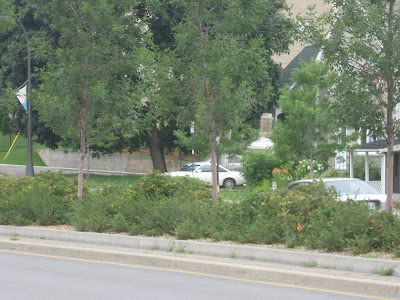
Here is Allumettes in Hull Gatineau. Remember when Hull was the poor cousin to Ottawa? Well, the story is different now. Note the decorative centre light standards, the lush planting, the close row of trees, all apparently thriving in their hostile climate north of Ottawa.


The centre plantings are so lush they partially obscure the cars on the other side, thus reducing the apparent width of the road and ameliorating its impact on the urban environment. Gatineau can do it ...


Close up of plantings and two rows of curbs. Plantings included rose buses, lavender, shrubs, and trees.


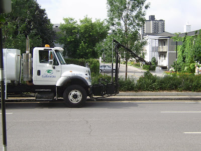
A maintenance crew doing a summer weeding. They told me its once a year.


After weeding, a watering (fertilizer?). The resultant lush attractive streetscape shows the results of the manicuring work.


Another section, planted solely in tall grasses.


Thick planting of attractive greenery makes a rich boulevard -- only in Gatineau you say, pitty.


An older section, with higher planter walls making a clearer separation of the roads on each side of the centre boulevard.


Carling Avenue boulevard. Other than the car models, its exactly the same as 1955. Will it look the same in 2055??


Tuesday, July 20, 2010

New and Improved ?


It has stopped raining. These puddles at the corner of Louisa and Preston are a real wet foot hazard and splash hazard to summer pedestrians; and will be slush and ice hazards in the winter.

We can put a man on the moon, send a politician to a conference, but somehow can't quite get the water to drain off crosswalks or sidewalks.

Thursday, July 15, 2010

The race is on ...


Preston reconstruction is almost complete. Final details are going in ... like the traffic loops.

The loop shown above is going to be installed right outside May's Chinese Restaurant at the corner of Somerset and Preston.

Except ... on August 3rd Somerset is going to be dug up big time for the same treatment as Preston got for the last few years: new pipes, utilities, and protected parking bays. Guess what -- the spot shown above will be getting a six foot or so wider sidewalk. And four trees.

Will the city get the wiring installed in enough time to get it torn out in August? Or will they be so slow the installation crews will arrive to find the road already gone??  Stay tuned for the great race...

Sunday, July 11, 2010

Lemieux Island area (iii)

Lemieux Island has a pleasant park on west and south sides of the Island. Most of the Island is fenced off to guard the water filtration buildings.

This vehicle-proof gate and lengthy stone barricade prevents vehicles from accessing a service road around the south side of the Island. The narrow road/path beyond has nice pedestrian-scale lighting and is a popular dog running / dog swimming / occasional-human swimming area.

The barrier to prevent unauthorized vehicle access, which is fine. But why does have have to block 100% of the paved surface, forcing peds to walk on the freshly seeded sides? Doesn't anyone plan for pedestrians or cyclists??


While not terribly attractive, this barrier on Echo Drive is much more pedestrian and cyclist friendly. Just cycle or walk on through. Easy peasy. No curbs to jump, nor fences to climb. This type of barricade is compliant with the ideals of bicycle boulevards (long stretches of street that thwart through-cars but encourage cycling).

Friday, July 9, 2010

Lemieux Island area (i)

The area of Ottawa near Lemieux Island is full of little mysteries. Shown above is River Street (no road signs...) which connects the Ottawa River Commuter Expressway to Lemieux Island. The road was recently rebuilt and seed sprayed on both sides after years of digging it up for the high pressure watermains.

The sides are fenced to keep cars from using them for Bluesfest parking.


South of the parkway/expressway, the little street is now named Sliddel, it runs past the city parking branch offices to the new traffic roundabout that makes a three point meeting of Sliddel with Bayview and Burnside Road. This is a very attractively landscaped little bit of roadway. I remain astounded the city put in such intensive landscaping in a to-be-redeveloped-someday-area and then it refuses to plant even a single tree in other neighborhoods (eg City Centre Avenue, or along Albert-Scott).


The nice landscaping along Bayview. The area beyond has yet to be remediated (de-polluted) and will someday be redeveloped with streets and apartments. In the meantime, the city steadfastly refuses (as it has since I started nagging them in the 1980's) to do any landscaping along Albert Street as it's "only temporary" although redevelopment is not likely before 2030.


Monday, July 5, 2010

Arty mainstreets

precast block awaiting its hole

Shown above is a precast foundation block for urban sculpture. When planted into a hole, only the top portion shows. Upon this plinth will be mounted civic art work. On Preston, these will be Italian-style columns. On West Wellie will be sculptural renditions of fire hydrants. The Preston art pieces will arrive mid-August, according to city officials supervising the final touches on the street.


precast block inserted in hole, surface pavers relaid 

I really look foreward to seeing these art pieces, as they will be the first of their type for an Ottawa main street, as far as I am aware. They are very different from the Bank Street bike racks, which are an artful rendition of a utility device. Clever. The west side sculptures coming this year will be sculptural art for its own sake. Two very different approaches, both valid, both enhancing the streetscape (we hope) and leading to more lively streets ... streets that are about more than just parking cars.

Friday, July 2, 2010

City discovers flat sidewalks !


One of my major complaints about Ottawa city sidewalks is that they grovel and contort themselves for the convenience of motorists. They dip low at driveways, so motorists don't have to rise up to cross the sidwalk, but the pedestrian must go down slope then up slope. Some sidewalks end up looking like roller coasters. These are difficult to keep clear in winter, and every driveway dip turns into a salt and slush puddle or slippery ice surface all winter.

Honestly, the city couldn't have designed a worse sidewalk for pedestrians if their goal is to thwart any pedestrian movement at all.

A few years ago, they installed a bunch of sidewalks in the "toronto style", in which the curbside part of the sidewalk slopes at every driveway but the lawnside of the sidewalk doesn't. This design is equally awful: it puddles at driveways, and the slope is so steep (eg along Gladstone west of Preston) it is scarey to walk on winter or summer. Gotta serve those motorists!

I was pleasantly surprised to see the design shown above being installed on Athlone north of Scott. It is a style I associate with Nepean and suburban areas: the whole curb is sloped, so motorists have to really slow down to cross it and climb the six inch height in a six inch run. But the real treasure is on the sidewalk surface: its flat. No roller coaster. No dipsey doodle. No 10 degree sidewalk tilt. Seldom any puddles or maim-the-elderly-so-we-don't-have-to-pay-them-pension ice puddles.

I had thought the city boffins didn't like this design, not for its sidewalk charactertistics, or its motorists characteristics, but because of its legal implications: because the curb is sloped, there is no physical indication of where the legal curb cut or dip is, so driveways can be widened without planning permission.

For whatever reason, I am delighted to see it on Athlone and look foreward to seeing it elsewhere.

Just for the record, here is an example of the idiotic extremes the city now goes to to avoid motorists crossing the curb having to climb any slope: along Preston, the sidewalks dips even when it is 15' in from curb ...


Ed.Note: David Reevely over at the Citizen picks up this story and takes it on:


Tuesday, June 22, 2010

Rememberance of people & things past ...


In Cambridge MA this neighbourhood commemorates people with signs. Virtually every corner was named after someone. A veteran. A resident.

Nothing special was done the corner to designate it a "square" as far as I could see, it was still the small inner city intersection of two residential streets.

But it certainly gave an amazing sense of history, of continuity, of neighbourhood, of topophilia, to the area. There were individuals here before you, who made a difference. Who were they?


If I was doing this in my west side neighborhood, I think signs honouring residents would be the start, but they could also commemorate events, geography, history ...

History is written by the victors, so the saying goes, and history tends to commemorate the upper classes who have the means to memorialize it.

For every cute wooden house in Upper Canada Village there were dozens of families huddled in tents, which are conspicuously absent from the village.

In citiies like Ottawa, neighbourhoods with clusters of academics and senior civil servants (or neighbourhoods that interest these classes) will get historic commenorations, like Sandy Hill, The Glebe, and Lowertown. Dundonald Park, surrounded by large victorian/queen anne homes, gets a historic name board; Plouffe Park gets a standard sign board. There is less history for the poor.

Monday, June 21, 2010

Beneath our feet


This inlaid paver pattern on Kent Street in front of the Hudson condo towers shows how a simple design can be effective for pedestrians and viewers from upper floors of the condos.

Most refreshingly, it broke out of the normal square patterns usually used, where some different coloured or textured blocks are substituted for others to make a pattern that keeps the overall rectilinear rigidity inherent in the blocks. In this pattern, the base blocks were laid over the whole area and then a saw cut was made in curvilinear pattern for the constrasting dark blocks to be inserted.

Iregular shaped blocks are not widely used in public spaces. Below are 'flagstone' type pavers with a cobble border and wider paver border.


Thursday, June 17, 2010

Street closures unfriendly to cyclists


This is a typical street closure in Ottawa. Closed to cars ... open to pedestrians ... and closed to cyclists? 

Cyclists approaching this particular barrier on Spruce Street can choose to ride on the sidewalk (naughty naughty) or squeeze through the centre bollard or side spaces (provided no one is parked close).

Why not remove the centre bollards and let cyclists carry on through? Yes, I know some motorbikes would go through too (they already do, on the sidewalk, I watch them daily do this on the Elm closure on the next block).

Wednesday, June 16, 2010

Bronson deja vu all over again

Last night was the second PAC (Public Advisory Committee) meeting on Bronson. After the hard time the city planners and consultants got at the first meeting in April, the May meeting disappeared in favour of a mid-June date.

The city and consultants got ideas from the public (me: the Bronson 2 lane plus two way left turn lane model) and the community associations (2 lanes plus turn lanes at intersections, a livable streets model that has worked so well for fixing roads with similar volumes in Toronto) and a lot of pressure from the Councillor to do better.

So they came out in full force last night. The city or the consultants hired more consultants to review their work (guess what: given the same marching orders and look-up tables, they came up with the same results -- well, duh!). They dragged out a planning junior who offered to stand at intersections with PAC members to consider how to improve ped movements -- if feasible and not interferring with car traffic flow. They brought in a landscape architect with large maps with huge coloured blobs on them identifying areas for pedestrian improvement and landscaping -- many of the blobs were on the paved road surface which is not exactly ped amentity space.

To cut to the nub:  the city inisists Bronson must stay as four lanes all the way through, no alternative configurations can be examined.

They did claim to abandon their prior suggestion to widen Bronson by at least 2'. Well, sort of. In an effort to promote consistent lane width, they would still widen Bronson in the area south of Gladstone; and in the north portion of the street where there was more land available, they proposed chewing away at adjacent green space to make the road lanes 35% wider than elsewhere. Mere details. 

Our planning politburo continuously chanted that their priorities were peds and cyclists first, transit, then private cars. Even the most naive participant would have a hard time swallowing that. For example, their ped first plans didn't quite allow for consistent minimum width (2m) sidewalks:  near Gladstone that meant sidewalks combined with bus stops combined with traffic signals and wooden utility poles would be a princely 1.5m wide.  On a busy corner. With the commercial storefront door also opening onto the sidewalk. Better hope those pedestrian hordes are real friendly. And turning cars don't cut too close.

The city planners rushed through the traffic and lane width stuff at breakneck speed, anxious to get to the brightly coloured dots (three colours! -- but alas no daisy shaped flower dots like I wanted) and magic markers (many colours!)
with which the remaining PAC members were to mark up big road maps with "suggestions" for consideration and implementation "where feasible" after "review by the TAC" (Technical Advisory Committee, ie the traffic engineers).

The landscaping proposals were somewhat attractive but severely constrained. Nice architectural drawings (planning porn) of benches and planters were shown, but won't actually be built along Bronson -- all the space has already been taken up by the pedestrian priority car lanes. Instead, they will be located on private property set back from the sidewalk where private property owners are willing to sign legal contracts permitting the city to do so. No word on how many of these planters and benches we might actually see, and many PAC members expressed scepticism that absentee landlords would ever consider these. Would even quasi-public landowners be intersted? --  the community minded Bronson centre itself has been busy removing trees each year and expanding the car parking zone in front of its building.
Double click to enlarge. The top two views illustrate a typical section of Bronson. Don't forget the car is speeding along at +60. The ped light is on the curb line, which is good. The proposed tree is on private property, if permission can be attained. The lower drawings show proposed treatment where parking lots abut the sidewalk. The planter and tree are on land cheerfully ceeded by the property owner who didn't mind the loss of revenue space.


The plans also showed lots of trees along the sidewalks -- of the side streets. These were shown based on the assumption that the Bronson reconstruction project would allow them to be planted there, as they were outside the current bounds of the project mandate. Oh dear.
\
But on Bronson itself, there wasn't room for any trees. So the architects proposed mechanical trees, artificial trees, that would be "planted" along the curb line with mechanical shading devices for peds. In the pix, they look sort of like those big plastic banana leaves you can get at IKEA to decorate your kids room. The tree trunks will help separate peds from cars.
Double click to enlarge. The top illustrations of are of benches, planters, brick pavers and other "landscape integration opportunities" all of which are on private property provided by willing and eager property owners. The bottom illustrations are of the bus shelter (also likely located on private lands) and the "architectural feature" are the artificial trees that substitute for the real thing since the pedestrian priority plans lack space for much of anyting except roadway.


It wasn't all bad at the meeting though. Staff and consultants were eager to be nicer than they were at the first meeting. They agreed to ped lighting along Bronson, with the posts located on the curb line (this is important as it restricts the apparent lane width, promotes subjective ped safety, and goes against the engineering view that the street and sidwalk should be one large open space for the safety of motorists and convenience of winter snow removal).

They proposed coloured concrete paving in the major intersections (easy to do! economical! they do it all the time!) even though that idea went down in cost and maintenance flames when studied for four years on Preston. Sidewalks will be made of concrete, perhaps stamped with a pattern, because interlock pavers like used on West Wellie, Richmond, Preston and other west side sidewalks "just won't stand up to our climate and heavy sidewalk plows and will look awful in ten years" (on this I share some sympathy: the city frequently demonstrates it is unable to maintain interlock pavers, whereas poured concrete is pretty simple stuff).

Summary: Car commuters to Pointe Gatineau win big. Peds get some lighting and fake trees. Adjacent land owers might get their front properties relandscaped provided they are willing to give up the space. Cyclists get nothing. PAC gets to hear more "mights" and "where feasibles" than normally treated to. Sidewalks get rebuilt, sometimes narrower, a few times a bit wider provided the room can be appropriated from green space. Decorative overhead wiring will stay on this "scenic entry route" to Ottawa.

C'est la vie in Ottawa.

Tuesday, June 15, 2010

Great for dog walkers


On Spadina Avenue in Hintonburg, as it approaches West Wellie, the city has planted trees on both sides of the street right on the centreline of the concrete sidewalk that runs up the rest of the street. The black post in the foreground is a bike rack that also serves to protect trees from plows, etc.

I find it curious that with all the spare space off to the side, the tree was planted in the direct line of the sidewalk. Are trendy Hintonburgers all so thin they can slip by this tree? Do they all walk dogs? Are the sidewalks not going to be plowed? Is it traffic calmings for aggressive pedestrians?

Monday, June 14, 2010

Collatoral damage

On May 3rd, new shrubs and trees for Preston are stockpiled near the street. Note especially the trees in the background.


On May 7, the shrubs and trees are planted at the corner of Primrose. Note the Bell person hole in the sidewalk.


May 10th, Bell removed the planted material and leaves them on the side of the adjacent building, bare roots exposed, no pots, facing south.


The greenery fades ...


Bell "restores" the site. Dead shrubs removed. Note the mulch area is compressed by the steel plates that were stored there. Some rose bushes of the "pancake" variety remain.


11 June, landscaping resumes. These trees were stored near the site, out of the ground, since 3 May. Not many leaves left. New shrubs supplied and planted. 

Not to worry, the city tells me. Bell had to pay for the new shrubs. 

It still spells waste to me. 

Friday, June 11, 2010

Another Bronson Plan

Members of the Dalhousie and Centretown community associations met to create a suggested Bronson layout that would be a first step to creating a more liveable street.  Here are my notes on the proposal for a new Bronson between Albert and Gladstone:

 Drawing up a plan by ourselves has certain disadvantages -- we cannot estimate turn lane lengths, for example. But we are suggesting these things to the planning group in an effort to get started on a plan that might, with tweaking, be acceptable to the neighborhood and many stakeholders.

First, let's differentiate this plan from the one recently outlined on posts last week on this WestSideAction blog. That plan, for 2 lanes of traffic with a centre TWLTL (two way left turn lane) was developed because I had the traffic literature and volume data to back up the suggestion, ie, I know it will work.

The plan we suggest now is one we have not had time to find traffic literature to support, but there are enough similarities to the 2+TWLTL that we think it will handle the same volume of traffic while delivering more neighborhood benefits. At this point it should be pointed out that while we target handling the current volume of road traffic on Bronson, we by no means consider this sacred: the city is growing, it cannot endlessly stuff more traffic onto Bronson, at some point, it's a "no more" situation, and we see no reason why the volume last week is more defensible a upper limit than a volume some day in the future. If the redesigned road handles slightly less traffic, or with slightly more delays, so be it.

The basic outline of the plan is as follows:

  • reduce Bronson to two through lanes, with additional left turn lanes at signalized intersections such as Laurier, Primrose, Somerset, Christie, Gladstone. This should handle the current volume without delays.

  • in between these three lane sections, introduce one parking lane, probably on the west side (as there are fewer intersections on that side)

  • only the two through lanes to paved in asphalt, parking bays to protected by curb extensions with trees and utility poles such as light fixtures. Parking bays to be paved in interlock pavers or textured pavement so there is a clear and consistent message that this is a two lane road and not a four lane road interrupted by bulb outs

  • this 2 lane plus parking bay layout will permit the widening of the side boulevard by at least two feet on each side of the road. Coupled with paving sidewalks right back to the property limit, we will achieve wider sidewalks plus room for curb-side planting of trees at 12-16' centres

  • an experienced landscape consultant needs to be engaged to plan a very aggressive tree and shrub planting scheme including the city aggressively incorporating the adjacent dead spaces between most buildings and the front lot lines, ie on private property

  • reduce the posted speed limit if required to accomodate a tighter built environment and traditional main street character

With respect to lane size, the two traffic lanes should be of the city's standard width for vehicles plus cyclists in mixed traffic. We are not suggesting a painted bike lane. The turn lanes should be of a standard vehicle width without extra space for cyclists as cyclists in the turn lanes should "take the lane" if mixed with traffic, or if less confident, pause at the far side of intersections and turn 90 degrees with to stay on the curb edge.

We suggest that in this plan, funding be set aside to improve the parallel low-traffic-volume on-street cycling facilty. In particular, consider making Percy Street a two-way cycling facility with southbound cyclists mixed with traffic on sharrow-marked streets, and northbound cyclists in a painted counter flow lane along the east curb that is well marked as a no-stopping zone.


Obviously, there are many details to be worked out, but we are attempting to address the most salient issues so that this plan can be drawn up and considered as a credible alternative to the current unsatisfactory four lane carbuncle now in place.

Here are some more specific suggestions for designing this street as a two lane street:

 Bronson/Albert:  on the NW corner, widen the sidewalk right back to the property line with a retaining wall by the Juliana (consider purchasing additional land here to widen the sidewalk another 3') and directing the sidewalk to vear NW (using some of the park space here, a stone retaining wall to hold up the sidewalk will be necessary) to align with the path on the west side of Commissioner; landscape lushly as this is a key pedestrian/cyclist link into the downtown core.

all one-way side streets approaching Bronson to be of the latest one-lane standard widths with lengthly curb extensions on the side streets (the current streets are a mish-mash of widths and many are too wide; the idea is to clearly signal that motorists have entered side streets and are not on cut-through arterials

all east-west crosswalks at all signalized intersections to be scored poured concrete; all north-south crosswalks at side streets and Primrose and Christie to be light-coloured interlocks

to reinforce the main street character and promote main-street style redevelopment, all Bronson sidewalks to be brick or coloured pavers, with appropriate celebratory fixtures at intersections

when laying out utilities, try to position manholes not on crosswalk locations; and fire hydrants not along the parking bays

Of course, there will be much consultation expected with respect to landscaping, ped lighting, overhead lighting, tree locations, etc but for now the above material should be sufficient to layout a street geometry for consideration by the traffic engineers and the larger community.

Recall also a previous suggestion that the road be restriped in August in the new layout for a trial period before reconstruction begins.

Thursday, June 10, 2010

Caring about Carling

Last night was the first Public Advisory Committee (PAC) meeting for the Carling Avenue reconstruction project from the O-Train to Bronson Avenue. Scheduled for 2011, its for a complete rebuild of the street: new sewers, water mains, dozens of cable and gas pipes, curbs, sidewalks, lighting...everything.

The handout emphasized the following priorities in this order: pedestrian, cycling, transit, vehicle. Of course, the the Technical Adisory Committee (TAC) had first whack at the project and they specified two through lanes in each direction, a bus lane, a cycling lane,very generous turn lanes, etc etc all of which exceeds the available right of way. Now, which elements do we guess might get dropped? No points for the correct answer: car lanes, bus lane, bike lane if room, "2m sidewalk (where feasible)". So much for ped priority. And for streetscaping ... to be added in at the end on the leftover spaces.

So, I spent the evening in plesant dialogue with the city planner and his consultants, educating them as to local pedestrian desire lines, questioning them on traffic volume assumptions, and suggesting the ideal Carling-Avenue-according-to-Eric plan.

These discussions can have fun elements. I pointed out the out drainage outlet for Dow's Great Swamp BEFORE the Rideau Canal was built and the dam built to create Dow's Lake, as it crosses Carling Ave it will present a "soft" layer of surficial geology (you can trace all through the neighborhood, its location revealled by the map and along the streets by the tilting houses on unstable foundations). I also pointed out the very busy Tim Horton's located on that strip, one which they (and many neighbours) are unaware.

Some agreements come easily: get rid of the acceleration or merge lanes at Carling EB at Preston, and Carling WB at Booth. This will also reduce the pedestrian crossing distances.

The TAC proposes this cross section: two lanes of traffic (plus turn lanes, some of which are VERY lengthy) plus one transit lane, plus one bike lane along the curb. The difficulty with the curb-side bike lane arises at Commissioner's Park (Dow's Lake tulip festival) where tour buses park against the curb ... and will be parking on top of the bike lane. Maybe the bike lane should be between the car lanes and transit lanes?

An idea well received was to replace the median lighting fixtures (which are sort of freeway style) with either outside curb  poles (located right on the edge of the curb, this helps close in the perceived road width thus calming traffic and protecting peds) OR with more decorative fixtures somewhat like was done on King Edward (but not with those particular poles), OR mid-height dual purpose lighting poles as was done along Bank Street south of Gloucester. The current lighting style is too freeway-like and must go.

 Does Carling have enough ped traffic to warrant ped lighting all the way along the sidewalks? Or would it be sufficient to mark intersections and where pathways join the sidewalk with clusters of lights and brick pavers in a ped scale, ie treating the sidewalk lighting as a series of nodes rather than a linear strip.

There is a grass median from the O-train to Booth. As we go east up the hill to Bronson, that shrinks to a dusty, dirty, heaved concrete wasted space. Since traffic volume decreases drastically east of Booth, to be 16,000 or so vehicles per day, I suggested two general traffic lanes are not needed, leave it as one lane(plus turn lanes) plus transit lane plus bike lane (since going up hill I have a harder time keeping to a straight line). This would allow for wider sidewalks, a side boulevard, or a landscaped centre median.

The centre median  itself is pathetic. The soil is compacted, the greenery is "naturalized" (ie, weeds). I suggest that the first foot in from the curb be porus pavers, then there be a 2' high concrete wall, creating a giant planter along the median. This planter would be filled to a depth of two or three feet with structural earth or planting mix, and planted with locust or russian olive trees (very salt hardy) and a dense underplanting of shrubs. [note that the city does not plow snow onto the median, only to the road edges, so the one foot setback from the curb should function fine].

The consultants were less than thrilled with the planter idea. Too much salt spray, it will kill it all. My response: the examples they cite are all suburban with huge rights of way and windy conditions, this is a more urban street with a lower speed limit (which could be made even lower, please) and the wall will reduce salt spray. If the trees die, then leave the planter with grass -- it will thrive better than it does now! Or plant something like decorative grasses that grow in clumps 12 and 24 and 35" high for a textured landscape, and that die back in the winter and are immune to salt spray.

I understand the engineer mentality might find the planter idea offensive at first glance. But let's be imaginative, experiment, try something .... even if it is only for two of the blocks (one east and one west of Preston?) at first. Build it. See if it works. Expand a year later if successful (this would require setting aside some budget for that from day one). Too often the city takes the cheapout route: the NCC will make nice landscaping over there, so we don't have to do anything at all over here.

Here are few other ideas to consider: ban right turns at Preston and at Booth on red lights, to calm traffic and make it safer for cyclists; don't make the sewer upstream from Preston the same size as Preston, make it one size smaller, so the upstream people (ie Glebe) don't fill it to capacity so it floods the downstream end.

And here's one idea that needs to be killed: the TAC wants a continuous left turn lane on Carling EB from Preston to Booth; AND a continuous left turn lane on Carling WB from Booth to Preston; AND a Carling WB right turn lane onto Preston. Will there be any median left? This proposal takes catering to rush hour traffic to the extreme. Why does the whole street have to be built to handle the ninety minutes of rush hour volume, and why are Pointe Gatineau commuters so privilaged as to determine the whole design of the street and intersections? Heck, they aren't even paying for this!

Our streets cannot handle 30-50% more traffic as the city grows over the next few decades  ... there just isn't room ... so why do we try? Build the roads for a balance of users (peds, cyclists, cars, transit) and balance of liveable city concepts, and drop the urgency to cater to suburban commuters. That means the rebuilding of Carling could handle the current traffic volume OR less. Then there would be no need to widen Carling as is in the current plan with its generous turn lanes. Unwidened, it can be made friendlier to peds, transit users, cyclists...and the environment.

Last note: the PAC set up for Carling consists of invited groups, individuals, property owners, BIA's, councillors. I represented the Dalhousie Community Assoc.  I was the only invitee who showed up for the meeting. There will be a general public meeting on June 22nd. In the meantime, let your councillor and community association know what you want, if you care about Carling.

Monday, June 7, 2010

Of Mascots and Marketing

Preston Street BIA in a brilliant marketing stroke invented Luigi, a mascot for their signage during the reconstruction years.

He was certainly popular. People got out of their cars to take their picture with him. Bluesfest goers gathered round the signs for group photos.

The volunteer T-shirts at last-year's Italian festival said Luigi's Security or something similar. Perhaps coincidentally, I noticed this Luigi doll on a doorstep.


Yet, the street seems strangely lonely now,  without his face on banners and signs.

I think he should be given new life. He adds personality to the street.
In a related vein, I saw in the paper that Vancouver's Chinatown held an online poll to select a mascot. They choose a cutsey panda bear for their mascot.

Sunday, May 30, 2010

Garden delight


This snap is of the the poppies growing in the community garden in front of the Dalhousie Community Centre, tended by Ida H.

She started another garden at the corner of Upper Lorne and Somerset, which is also thriving.

Saturday, May 29, 2010

Sidewalk sales


One of the purposes of the new wider sidewalks on traditional mainstreets is to encourage merchants to display merchandise outside, which enlivens the environment with changing displays. Recently, Preston Hardware has started taking advantage of the very wide sidewalk in front of their store.

Part of the display is pretty ordinary hardware stuff: wheelbarrows, lawnmowers. The BBQ on a stone-faced cabinet is more different, and reflects the trend to "outdoor kitchens", although a visit to any of the remaining Italian households in the neighborhood will reveal a kitchen in the garage for summer cooking and pickling. There is a house near mine where the Asian residents have a large outdoor grill (perhaps removed from a chip wagon) attached to the window frame and they cook outside by reaching through the window.

In the fall, I expect the hardware store to have wine barrels, crates of grapes, etc on the sidewalk, like Musca's does now on Somerset Street.

What else would be interesting for a hardware store to put out on the sidewalk? Sledge hammers? shower stalls? waterless toilets? A door knob display? Let me know what you think would be neat on the sidewalk, and I'll pass the suggestions on to Preston Hardware.

Thursday, May 27, 2010

Cycling Progress

The Public Advisory Group for the proposed downtown-area segregated cycling track meet last night. It's a diverse group including 3 BIA's (Chinatown BIA, Somerset Village BIA, Bank St BIA), two community associations (DCA, CCA), cycling advocacy groups (Cycle Vision Ottawa, Citizens for Safe Cycling), politicians former and current, etc.

City planners unveiled the route choices and the criteria they used to narrow the list down to a smaller set of five leading options. They applied a numerical rating scheme to winnow the choices, which came in for a lot of discussion. The selection remains somewhat arbitrary and contestable.

The most remarkable thing about the two and half hour session was the dialogue between the various parties. Unlike some recent public meetings I have attended where the focus is on loud sound bites establishing positions, the discussion last night revealled that the cyclists understood business owners' concerns, the attendees could see the political minefield, there were some admissions from the BIA's that segregated cycling tracks might actually have some benefits for the downtown community and businesses.

Councillor Holmes emphasized that rather than the top scoring project being selected, it had to also satisfy all 3 key stakeholder groups (business, residents, cyclists), but her preference for putting the track on quiet residential streets parallel to the main streets like Somerset, met with determined opposition from cyclists who felt the track had to be where cyclists want to go. And cyclists want to go to the same places as motorists -- the main street.

A couple of key observations:
  • the city's technical criteria were very tough, as it sought to minimize car displacement. But the downtown isn't exactly overflowing with spaces not already dedicated to some current use, especially the car. Something's gotta give.
  • the city's criteria considered cyclists' desires only within the designated study area, and while they were aware that cyclists connect with adjacent areas, this was not measured. Obviously the Corktown Bridge over the canal and future Somerset bridge over the Rideau River to Overbrook were big on cyclists' minds.
  • the criteria evaluation form was too complex to present at a public meeting, yet on closer examination by the PAC was found to be too simple and too easily contestable. In short, it would satisfy no one.
  • all the top five route options use Somerset west of Bronson. This is a major problem for the Chinatown BIA as the street is the major parking supply and delivery area, and there are no nearby alternative parallel streets and residential streets are already overrun with cars. Suggested solution: limit the segregated track, from Percy/Bay to the Canal.
  • the business of business is business, regardless of what mode the customer used to get to the business. Business owners have to move beyond car parking focus. I was surprised to hear a BIA rep complain that off street parking lots were being "lost" to condos. Does anyone contest that the condo delivers more customers than the parking lot ever could? Question: will a bike lane here deliver more customers than on-street parking does?
  • I cannot imagine that the Merivale strip (or similar suburban strips) would be made atttractive to pedestrian shoppers or cyclist shoppers by improving the landscaping along Merivale. Face it: it is a car-oriented form of development. Downtown BIA's have to stop trying to provide more parking than the suburban big box lots -- it just cannot be done without destroying the very urban features of the downtown neighborhoods that attract residents in the first place. Downtown businesses have to get over thinking of themselves as "regional attractions" for suburbanites and focus on their real market. This includes tourists visiting the core, local residents, local businesses, etc. Merivale strip will never be a tourist destination; downtown shouldn't cater to cars.
I found myself wonder, where do business owners live? Too many that I know live in the suburbs while having their businesses in the central city. Thus they commute by business-expensed car. They live their evenings and weekends in a suburban lifestyle. It's not surprising then that they want convenient parking (preferably provided free, by the taxpayer) for their business, as that is how they structure their own lives. I wonder if business owners who live in the core, who walk to work, have the same mind-set that favours car shoppers and car parkers, or if they are more open to the benefits of wider sidewalks and improved cycling facilties as being the cheapest way to get more customers coming by their place of business?

If there was a consensus last night, it was that dialogue was good, the groups understood each other, that a rushed choice might well be a bad choice, and maybe it would be better to talk more and select the route mid-winter for install in spring 2011 rather than late fall 2010.

Note: for 20-some years I ran a storefront business. Only a tiny portion of my customers came by car. But 99% of comments about location came from car drivers. I think in many ways its like the weather: people seek safe topics for small talk, chit chat, and "isn't parking awful" is a safe, seldom-contested tongue flapper. Downtown businesses need accurate data about who shops and what the future can be. They have to ignore the "noise" about parking and focus on improving business. Businesses fail all the time, for a variety of reasons. During construction, it is easy to blame the road work. Post bike track, it will be easy to blame the cyclists.But mostly businesses fail because the owner misjudges the market. Correlation to road work, or cycling tracks, is not causation.