Showing posts with label bike path. Show all posts

Friday, July 23, 2010

Highway to nowhere


The city's roads department has its signals branch located on Gladstone on either side of the O-Train cut. The yards are full of signal poles and light fixtures. Mostly these lights are "out" at night; but one recent evening there were multiple heads cycling through red-yellow-green.

 Immediately behind them is a dense patch of bush, through which a ped path winds that will someday become the cycling path along the Otrain corridor.

Sunday, July 11, 2010

Lemieux Island area (iii)

Lemieux Island has a pleasant park on west and south sides of the Island. Most of the Island is fenced off to guard the water filtration buildings.

This vehicle-proof gate and lengthy stone barricade prevents vehicles from accessing a service road around the south side of the Island. The narrow road/path beyond has nice pedestrian-scale lighting and is a popular dog running / dog swimming / occasional-human swimming area.

The barrier to prevent unauthorized vehicle access, which is fine. But why does have have to block 100% of the paved surface, forcing peds to walk on the freshly seeded sides? Doesn't anyone plan for pedestrians or cyclists??


While not terribly attractive, this barrier on Echo Drive is much more pedestrian and cyclist friendly. Just cycle or walk on through. Easy peasy. No curbs to jump, nor fences to climb. This type of barricade is compliant with the ideals of bicycle boulevards (long stretches of street that thwart through-cars but encourage cycling).

Tuesday, May 25, 2010

Boston cycle path

The following pictures were taken on the cycling path along Vassar Ave in Cambridge (Boston) MA. Vassar goes through the MIT campus, and recent streetscaping had been done to narrow the road, add boulevard trees, and a bike path which was heavily used when I viewed it on several occasions. In the picture below, it transitions from on-road to being at the same grade as the sidewalk, set back from the street by a row of trees.


Despite being in front of the most prestigous engineering school in the world, there is a puddle in the path.

The path was blue asphalt where cars and cyclists shared pavement. Here is a car crossing of the path. Note the car has to rise up a slope about six inches which helps convey the message to the driver that they have left the car realm:


Note also the paving change where the sidewalk is crossed by the driveway.

The photo below shows another example. The path is set back from the travelled portion of the road about 16' -- the width of the parking space plus the boulevard with trees. The example below allowed vehicles to access a small parking and loading zone. Other crossings were at building entrances (drop off and pick up zones) and into very large parking garages which would have a similar traffic volume to many residential streets.

Here is a closeup of the sign that advises motorists to watch for cyclists and yield to them:


Here the path passes by the parked cars in the distance, the path is blue where it crosses a driveway, and has rougher textured pavers and then ped pavers where it crosses a major pedestrian path at an intersection (foreground):

Thursday, March 25, 2010

Cyclopiste de Preston (vi)

Most of the photos in the previous posts on this cycling route showed the path in winter or early spring. That is not the most attractive time of year. Here are a few shots in summer, to show what a pleasant route the Cyclopiste de Preston could be for cyclists and pedestrians; for recreational, short-haul and commuter users; and for easy access to and from the Preston mainstreet.

Wednesday, March 24, 2010

Cyclopiste de Preston (v): Young to Carling

From the turning circle where Young meets the Otrain cut, there is a convenient bridge over the train. Note the lack of curb dip on this end for cyclists (there is one at the other end of the bridge). A similar but wider and more friendly overpass is planned for Hickory Street, a few blocks south near the Otrain station at Carling Avenue.

Looking south, the stonedust path passes between the backyards of houses and the Otrain cut. The path needs to be widened and re-covered with stone dust which is worn down to the mud in some spots. There also needs to be a curb dip to access the path. Throughout its length, the current path lacks dips.


In the two pictures below (taken summer 2009) cyclists arrive at Beech Street and hesitate, looking for a sidewalk dip to cross the street. They decide to go east, riding on the sidewalk, to the first driveway dip a number of yards away. They then faced an awkward and dangerous sharp turn onto the street (having to similtaneously look over the shoulder for overtaking traffic on the road). But once onto the street, they discovered there is no matching curb dip on the other side of the road, and had to cycle some distance the wrong way on the road before giving up, dismounting, and lifting the bike over the curb, to ride on the sidewalk back to the continuation of the path. Is this an official city cycling route?
The last portion of the path is  lit and paved, from Sidney street to Carling Avenue, by the Otrain station and Dow Honda:


Once at Carling, the continuation of the path is visible on the south side, this time illuminated by the NCC:


Crossing Carling is a bit of a problem. The city advises cyclists to dismount, walk their bike a few hundred yards east along the sidewalk to the intersection of Preston, walk across the crosswalk, and then walk the bike back west along the far sidewalk to the resumption point of the path. Of course, I just dismount, walk my bike straight across, and wait in the wide median for a break in the other direction to cross the far lanes. A curb dip would make it even easier. The City claims it cannot put traffic lights here as it is too close to Preston. An underpass is a more expensive option that might be feasible if the Otrain is double tracked for the LRT and needs a wider underpass.

Tuesday, March 23, 2010

Cyclopiste de Preston (iv) Gladstone to Young

The Cyclopiste de Preston is a cycling arterial running from the Ottawa River - Bayview - under Somerset - cross Gladstone - under the Qway using an existing underpass - and joining the existing ill-maintained path running from Young Street along the Otrain corridor to Carling and then further south. The path is in the Official Cycling Plan, but since work started in 1962 has been stymied by lack of an underpass under Somerset street. Detailed design work for the underpass is underway now, as part of Somerset reconstruction. If enough people support the idea (tell your councillor!) the underpass would be built in 2010-11 and presumably the missing bits of paths too.

Previous posts covered the distance from Albert/City Centre Ave (the temporary north end of the route pending the East-West LRT construction) to Somerset, under Somerset, and slightly upslope to Gladstone.

Once the cyclist or pedestrian crosses Gladstone, there is already a well used informal goat track along the route:
The path proceeds south between the city signals storage facility (on the left) and the Otrain cut (on the right). Despite looking rather narrow and maybe a bit forbidding these tire marks indicate some cyclists know about this route. I cycle it numerous times each summer:


The path approaches the existing Qway underpass from the south, but first it has to make it way past the unpaved (and uncleaned up) parking lot on city land behind the St Anthony Soccer Club. This is an important parking lot for events there (despite its disorganized and dirty state) so I expect the cyclists will simply use one paved aisle of the parking lot to cross it:
The city has kindly installed signs to remind cyclists and parkers that this is city property. Somewhere along here, a Gladstone/ Preston LRT station is planned. It would be down in the cut, with access up to ground level at various locations.

The picture below shows the underpass under the Qway. It is wide but bleak and forbidding; some imagination will be required to make it more attractive and user friendly:


Lastly, the route comes out at Young Street, which has a turning circle, and a convenient pedestrian-cyclist overpass over the Otrain cut into the Civic Hospital neighborhood, and a short jaunt east to the Preston Square/Adobe office complex on Preston:

Monday, March 22, 2010

Cyclopiste de Preston (iii), south of Somerset


Picture 1 is the view from the Somerset viaduct looking south towards Gladstone and the Queensway. The Otrain track is barely visible in the cut on the right. Most of this land is City owned (a small portion is NCC, but it is not required to make the underpass). At the Somerset end, the right of way is quite wide. It would be relatively straightforward to connect the Somerset bike lane and sidewalk surfaces with the bike route using a slope, although a switchback might be required. A 16' drop requires 320 feet of ramp, plus some flat spots.

To the left of the Otrain tracks is a wooded slope. If you look closely, there is a spur or siding line that used to run up this slope, ending at Gladstone. This provides a ready start for the Cyclopiste to climb the grade from track elevation up to Gladstone Avenue.


Running right through the centre of picture 3 (above), going left to right, is the former siding slope waiting to be converted to a ped-cycling route. The PWGSC warehouse is in the background.


Bits of abandonned rail sidings can be found amongst the garbage and overgrowth along the Otrain corridor.


This is the view from the Gladstone sidewalk,  looking back along the corridor towards Somerset. The Otrain track is to the left, PWGSC warehouse and Preston Hardware are to the right. The former siding located here gives us an ideal slope for the taking the Cyclopiste downslope to the track and then under Somerset.

Tuesday, March 2, 2010

Puddlegineering


In yesterday's post, I lamented the ability of our city to install puddles right at pedestrian crossings, or huge lakes on brand-new multipurpose paths. In many cases, these puddles appear because the "lowest spot" on the road is right at the pedestrian crossing, the better to be enjoyed by wetfooted citizens.

The puddle shown above required real skill to be installed. Notice that it is on the highest point of the road -- the crest of the hill as Somerset goes up and over the Otrain track. This puddle is large enough that it lingered there for over a week each time after it rained during last summer. Now, as the curbside glaciers retreat, the puddle is back again right on the new Somerset bike lane.

Alberta and BC have hanging glaciers -- frozen rivers of ice high up on mountain sides. In BC and Switzerland, hanging lakes are located in little valleys high up on hills and look disconcerting to the eye since lakes should be down, not up. But Ottawa, now that's home to the hanging puddle!

Wednesday, February 10, 2010

First expansion of Cycling Sundays in years ...

there is a fragmented path along the east side of the Otrain corridor in Little Italy

The Preston Street BIA (PBIA) is working on a marketing idea for closing Preston on cycling Sundays. The Preston street closure would connect the Ottawa River bikeways to the Rideau Canal paths. The PBIA is in logistics discussions with NCC and City. The idea is to make Preston street a useful link in the bike network, opening up new routing combinations, and making the street and its café’s a destination for cyclists. They are trying for July 2010 only as a trial. The street should be attractive to cyclists and roller bladders as it will be freshly repaved and very smooth.


 If the whole street is closed, volunteers or paid staff would be needed for each cross street/intersection. For that reason, they are also examining a model whereby only one half of the street would be closed to cars, for example, the southbound land would become a bike zone and cars would use the street northbound to access restaurants and residential street.

 They are planning to use the Preston “extension” which leads out to a legal crosswalk over the transitway and then connects to the existing NCC cycling paths. This route is also of keen interest to Bluesfest for crowds to access the park in front of the War Museum.

Cycling Sundays on Preston is a welcome initiative on the part of the PBIA. It may lead to further development/completion of the cycle path fragments along the Otrain corridor. The city cycling plan identifies this corridor as a cycling arterial. Maybe the PBIA will promote the improved path and see it branded as the CycloPiste d'Preston.

Saturday, January 23, 2010

Where cyclists cross ...


Multipurpose path, aka a bike path, crosses a parking lot entrance. This is a crossing, not an intersection. Notice no painted crosswalk for the pedestrian users, as the crossing is not at an intersection. If at an intersection, there would be a painted crosswalk for peds, and cyclists are supposed to dismount and walk their bike across the road...

I like off-road cycling facilities like the NCC bike paths. I like painted bike lanes too. I think I would like physically segregated bike lanes along roads, too, but Ottawa has too few to experience.

One of the things I like about the NCC paths is they are set back from roads for the most part, and have grades and turns suited for cyclists rather than motorists. I like the set back way the Ottawa River path crosses River Street (road to the Lemieux Island filtration plant), then the Kitchissippi lookout road, then the Westboro Beach road, then the road to Britannia Beach.  What is in common for all of these crossings is that they are set well back from the nearest intersection. Cyclists and motorists can see each other well before they cross; there are no surprises from fast-turning-then-accelerating vehicles at intersections that whip around the corner then come face to face with a soon-to- be-roadkill cyclist or biped. It has been my experience that most motorists are polite and alert for cyclists at these crossings.

I recently wrote to the NCC suggesting that at least some of these bike-road crossings should be rebuilt a bit so the cycle path has the right of way over the entrance to a parking lot, for eg, the bike path could be raised on a speed bump that forces vehicles to slow to a crawl, and perhaps appropriate signage added.

The NCC response: Giving cyclist and pathway users priority over motorists is a new concept that needs to be closely studied, taking into consideration various factors, in order to ensure the safety of all pathway users. We understand the concept you are proposing of promoting the development of barrier-free utilitarian cycling facilities. We will re-examine the pathway crossings configuration with roadways at future rehabilitation projects for each pathway. That is a good answer, and is not a "no".

In contrast, correspondence with the city regarding how cycling paths cross roads, elicited this: There is even greater potential for dangerous situations where cyclists use these midblock crossings as they move faster and make it more difficult for a motorist to see them approaching. Both the city and NCC tend to be removing midblock crossings (by rerouting facilities) for the above reasons.

I remain puzzled at how rerouting a cycling path from a crossing a hundred meters from an intersection to being located at the intersection improves anything. When at an intersection, the cyclist is supposed to dismount and walk his or her bike across the offending parking lot entrance or roadway since cyclists cannot (legally) ride on a crosswalk. This rule is likely to be flouted. The turning vehicles are less likely, not more likely, to see cyclists.* And don't 70% of cycling collisions occur at intersections? That strikes me as a good reason to avoid them.

I prefer the NCC response to the City's.

*all right, I confess to being a criminally reckless parent. I always taught my kids to do as I do: cross mid-block rather than at intersections. There is usually fewer lanes of traffic, and it's coming from predictable directions at predictable speeds. (The exception to this is downtown core crossing, where everywhere is too dangerous). I used to be a rare loony with this attitude, but find more and more people expressing the same thought. Conventional traffic planning wisdom is all in favour of cars and penalizes those idiots who ride or walk. Rerouting cycle paths to meet roads only at intersections is more car-centric thinking.

Thursday, January 7, 2010

More Detroit can do it ... can Ottawa?

http://www.metropolismag.com/


Shown is the Dequindre Cut, a former sunken rail line running through downtown Detroit. The St Clair River is in the background, with Windsor on the far (south!) side.

Detroit is reserving some of the cut for a future LRT line, but first it has built a bi-directional bike route and accompanying pedestrian path, with landscaping. Because the path is grade-separated from the street grid it is fast, direct, intersection-free, and has freeway-style on and off ramps that take cyclists in and out of the cut.

Detroit feels it is lucky to have a straight-line bike path going directly through the heart of established neighborhoods directly to the downtown and the riverfront recreational lands.

Do you notice the similarity to the Scott Street alignment where we built a sunken bus transitway 25 years ago and where we are now looking at a proper bike facility BikeWest? Do you notice the similarity to the OTrain cut where CPR lines were burried in 1960, where we have demo rail service but alas, still only bits and pieces of a bike route? Will the new LRT line that crosses LeBreton Flats just south of the current transitway be a stand-alone feature or will it have an accompanying grade-separated bike route into the downtown core?

We may get the BikeWest route someday, or the Cyclopiste de Preston, but only if we nag or politicians that we want first rate bike facilities and not just pretty signs nailed to telephone poles on the sides of roads.

Thursday, December 31, 2009

Winter Cycling Path Maintenance


Alright, I admit that the multipurpose path on the north side of Albert between Bronson and Bayview is not really an official cycling path. If it were, it wouldn't be plowed in the winter, because the City and NCC do not maintain cycle paths in the winter. But since this is officially a sidewalk  ... it just happens to look like and function like and get used like a bike path ... it gets plowed and winter maintained.

I thought this path provided some insight into the feasibility of winter cycling in Ottawa.

Tuesday, December 29, 2009

Boring Job


Whilst walking along Somerset Street just west of the OTrain track, at Breezehill, I came across these gents taking bore-hole samples from the street. Little painted notations every few meters along the street indicate that they will be doing this for weeks.

I will nag the Somerset street planners for one bore hole result in particular. It will be the hole bored just a few meters east of the OTrain underpass. Eventually, a segregated bike route (CycloPiste de Preston?)  will be finished along the OTrain corridor, and to be useful it will likely have to pass under Somerset Street. Will it be possible to carve out a cycling tunnel along side the Otrain underpass?

If the viaduct (raised road surface that is Somerset Street) is composed of gravel and rock, it could be possible to pump that space just east of the Otrain underpass with grout (liquid cement) until it is solid, then carve out a bike route underpass parallel to the Otrain underpass. This would avoid digging up the road and building a cycling underpass in a cut and cover operation.

Sunday, December 27, 2009

CBC Interview on BikeWest

Last Monday, CBC afternoon show interviewed Eric Darwin about progress BikeWest apparently made at transit committee. You can hear the short interview by clicking here: http://www.ericdarwin.ca/CBC_Interview_2.mp3.

The text of the BikeWest proposal (downloadable) can be found at this coordinate: http://www.ericdarwin.ca/BikeWestReport.doc. However, note that I do intend to update this document in the next two weeks to reflect newer information. The report is rather fat, because it has a lot of pictures in it.

Monday, December 21, 2009

BikeWest on CBC radio Monday


The route, from downtown to westboro


Possible intersection-free alignment along the LRT through LeBreton flats.


The CBC afternoon show will do a live segment on the BikeWest project Monday just after the 5pm news. If you can't listen in, I'll post a MP3 of the interview in a few days.

Wednesday, December 16, 2009

BikeWest motion passes Transit Committee

Faithful readers of this blog will recall I promote a cycling project called BikeWest.

It calls for a off-road bi-directional cycle route parallel to Scott and Albert Street between Westboro and the downtown. The city owns the land all along the streets, on the north side.


I am concerned that the DOTT  LRT project could block BikeWest at two key points, Bayview Station and Tunney's Station. Since transit committee was considering the LRT project, I spoke at the meeting, and asked friendly councillors to present a motion. But I got more than my minimal goal. Transit Committee passed a motion instructed staff to consider
- attaching the BikeWest path to the south side of the LRT route from Empress to Bayview, which if built would give Ottawan's a grade-separated no-intersection bike route for the first kilometer of so out of the downtown core
- what options we have for the Otrain overpass (more on this in a subsequent post)
- how BikeWest can safely pass the Tunney's station.

Before the motion was voted on, Councillor Legendre demanded of staff where BikeEast was as his consitituents deserved similar facilities.

I am delighted. Here is the key part of the motion that was passed:

Be it resolved that the subsequent design phases of the DOTT project include examing the possibility of including space for a segregated off-road bi-directional cycling path along the south side of the LRT alignment from Empress St to Bayview, and

Be it further resolved that staff evaluate options for including a bike route overpass over the Otrain cut at Bayview as part of the Bayview Station planning; and

Be it further resolved that staff explore options to ensure that there is room for the BikeWest project to safely pass the Tunney's Station on the south side between the station and Scott Street.

Of course, this does not mean BikeWest will be implemented. But the idea now has training wheels and is going foreward.

Wednesday, December 2, 2009

Bayview-Carling CDP Re-Activated !


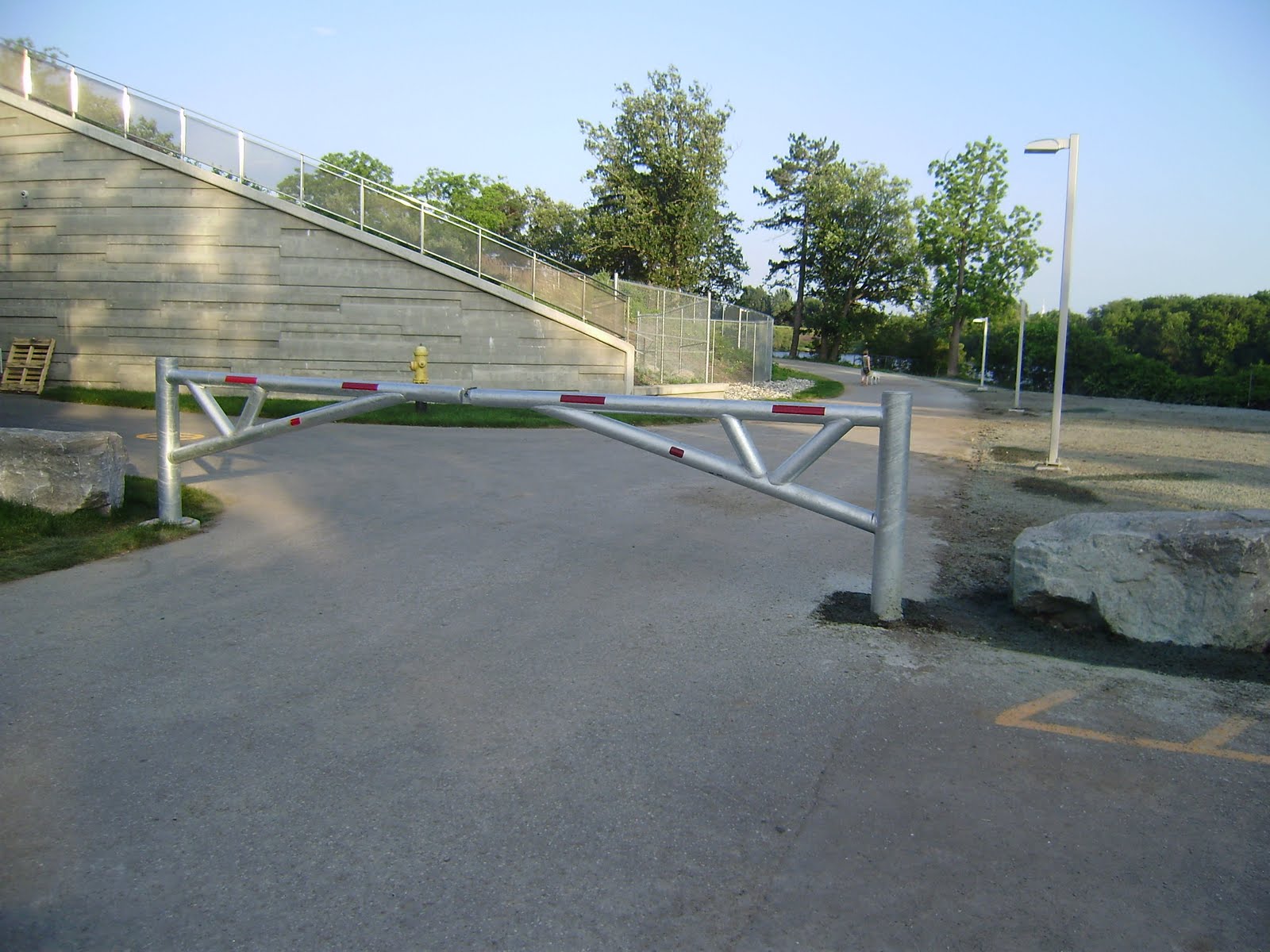
Along the OTrain corridor is this hidden gem.


After a long struggle by residents and the neighborhood associations (the Dalhousie Community Association and the Hintonburg Community Association), and with much behind-the-scenes pushing by the concerned Councillors Holmes and Leadman, the Bayview-Carling Community Design Plan has been reactivated by the city.

The focus of the plan is Bayview Station to Carling Avenue, along the OTrain track, which is currently the subject of a development frenzy by condo and office developers who feel the time is right for the rebirth of this former industrial zone. No doubt some of the "time is right" feeling comes from the impending completion of the Preston Streetscaping project that puts Little Italy firmly into the trendy neighborhood category.

In the early 1960's, the NCC paid to remove many of the railway lines in Ottawa, as "relics" of an industrial era unsuited to modern government cities. (My first government job was with the Cdn Transport Commission, a quasi-judicial and regulatory body, where I researched and wrote the first analysis of the relocation process and what it accomplished). Most of the rail lines, condemmed as barriers between neighborhoods, were replaced by roads, such as the Queensway, Colonel By Drive. Other roads, such as the Champagne Arterial which would have run from Fairy Lake Parkway over the River through Dalhousie, through the Carleton Campus, and join the Ottawa Airport Parkway by the Taxation Building, were not completed). In retrospect, the highways that replaced the railways are bigger barriers and problems today than the rails were before. Someday we may wish to convert them back to rail, especially Colonel By Drive and the Alexandra Bridge.

The CDP is another chance for the neighborhood to gets its wishes into the planning process. While a lot of the planning horses have left the barn, there are still some that can be harnessed. Most particularly, I will be pushing for Transit Oriented Development that has some teeth, additional pedestrian crossings of the tracks at Hickory and elsewhere, a real north-south bike route from the river to Dow's Lake, a larger  park at Beech.etc.

The first meeting, primarily aimed at getting participants in the original study back into the process, will be the initial Public Advisory Committee meeting on Thursday, December 10th, 7:00 - 9:00 p.m., at Room 4102E/4103E, City Hall. The rooms are located on the fourth floor at City Hall.

Saturday, November 14, 2009

Gates of Lemieux Island re-installed


The access road to Lemieux Island water plant has been badly torn up for the construction of the high pressure water mains to the Island. Finally, the road is reappearing, although as you can see from a careful examination of the photo the new road is relocated to the left. During the construction, the ornate gates -- which look like they belong to Her Highness the GG instead of here -- were removed and this shows the eastern side gate and pailings reinstalled.

Friday, October 23, 2009

DOTT plans affect west side residents (xi): BikeWest

The city cycling plan includes conceptual improvements for cyclists heading west from the core towards Westboro. Councilor Leadman is fighting for improvements to the ill-designed Scott Street mixed-use path and a connection to the downtown. Cycling advocacy groups want better cycling facilities. The BikeWest plan proposes a segregated bi-directional cycling path on the north side of Albert and Scott from the downtown (Bronson Ave) to Westboro.

One of the original purposes of the BikeWest plan was to tie into all the construction projects planned along the Albert-Scott corridor. It is important not to construct anything that permanently blocks cycling improvements, even if the cycling improvements are not yet being built. It is also economic and thrifty to tie in cycling path improvements to new major road and LRT works planned along the corridor.

Working from the downtown west, the currently proposed DOTT plan does not adversely affect BikeWest between Bronson and Booth. It remains to be seen if city planners can be convinced to include BikeWest either along the north side of Albert or along the new grade-separated LRT alignment. The intersection of Booth at Albert remains a horror for local residents and the new intersection plans make it worse. It remains to be seen if the intersection can be scaled down, single-occupancy car motorists tamed instead of catered to.

In the latest DOTT plans the Preston extension will be built very early in the LRT construction process. This opens a few opportunities to facilitate the cycling experience in the E/W and N/S direction. It all depends on the willingness of council to direct that cyclists be treated seriously. However they design this road feature it is unlikely to create insurmountable cycling problems.

The Bayview Station design calls for a huge widening of the current transitway bridge over the OTrain cut. It would be economic to widen the bridge a bit more to include a segregated bike path beside the new station platforms. This would overcome the biggest hurdle for westbound cyclists: getting over the OTrain tracks. The current Albert St alignment has narrow sidewalks and very fast moving traffic that creates a cyclist-unfriendly environment. It is especially inconvenient for downtown-bound cyclists to get from the Scott path over the tracks to Albert Street.

At Tunney's, cyclists today are supposed to cycle on the north side of the Scott Street sidewalk/bus platforms. For much of the station length this is not a major problem with the current bus passenger volumes. However, when Tunney's becomes much busier it will be a major difficulty. Unfortunately, the current DOTT plan continues the unsatisfactory cycling-unfriendly  arrangement.

It is possible to do much better, and cheaply too. Recall that the new platform shelters for the LRT deep in the cut, will have roofs level with the ground at the Scott Street side. The City proposes a "green roof" here. They also propose widening the pedestrian overpass by 3x, while keeping the current elevator shafts, stairs, and exit buildings. It would not be difficult nor expensive to use the LRT platform roof as additional pedestrian areas, with entrance doors directly onto the new widened pedestrian bridges. This would reduce or eliminate the current exit that opens directly onto the bike path. While not ideal, since pedestrians would all have to cross the bike path at grade to get to the bus stops, it would be an improvement over the current plans.

Even better would be for the planners to sit down with cycling advocates for a few hours to hash out some ideas for reducing conflict. Note that the conflict with the sidewalk and station exists whether a bi-directional segregated bike path is built per the BikeWest model, or a uni-directional path is built along the edge of Scott Street itself. Opportunity knocks, will cycling be given a boost or a permanent block?

Thursday, October 22, 2009

DOTT plans affect west side residents (vii): Bayview Rapibus Station?

The City has been evaluating the structural soundness of the historic Prince of Wales Railway Bridge over the Ottawa River to Gatineau. The City bought it a number of years ago for transit.

Friends of the OTrain and  LRT transit proponents have long viewed the POW bridge as a great solution for taking transit across the River. The interprovincial transit study offered renewed hopes for extending LRT service from downtown Ottawa to Gatineau over the POW as the first phase of a loop system serving the two downtown employment centres and to alleviate bridge congestion. Alas, logic may be loosing out to other concerns.

I gather that a leading proposal for addressing interprovincial transit woes is to widen the POW bridge to a two lane transitway (not LRT or OTrain) to bring the Rapibus system (Quebec's new bus rapid transit system just like Ottawa's 25 year old transitway) over to the Ottawa shores. A transfer station and bus storage area would be constructed under the new Bayview Station, connected by elevators to our E-W LRT line. The Rapibus terminal would be in place until such time as LRT was extended across the River. Of course, building a new terminal and widening the bridge * will work to delay that day by at least a quarter century.

 I dislike the idea of building a bus parking lot on valuable LeBreton and Bayview Yards development lands. Extending the LRT across the river and having it service a transfer station on the Gatineau side and having a terminal station at Place de la Chaudiere makes more long-term sense to me. The interchange at Bayview would then be much smaller, more efficent, and technologically advanced. Has the interprovincial study really gone so far "off the tracks" and gotten stuck in bus mode?

* I hear rumors to the effect that the existing POW bridge is in really bad shape, and may only be worth the scrap value of its steel, and that to extend either bus transitway or LRT service from Gatineau will require a totally new bridge. In any case, double tracking it, converting/widening it to two way bus way, or building a new bridge altogether will be very expensive. Mind, a bike and pedestrian link along the bridge would make for a wonderful new link in the bike network.